
The strongest cold wave this winter has hit, with local temperatures dropping by 18°C! Why is it so cold these two days?
|
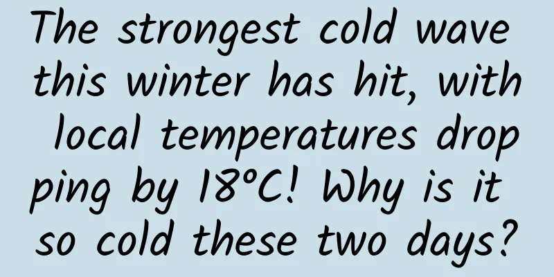
Cold, cold, cold... Have you felt the sudden drop in temperature in the past two days? I don't want to leave the warm bed in the morning, and my hands are frozen when I play with my phone on the road. The Central Meteorological Observatory continued to issue a yellow warning for cold waves on the morning of November 27. It is expected that from tomorrow to November 30, the cold wave will affect most parts of China from west to east, and the temperature in most parts of northern China and central and eastern China will drop by 10 to 16 degrees Celsius, and the temperature drop in some areas may reach more than 18 degrees Celsius . A "cliff-like drop in temperature" is coming, and "winter" has truly arrived from south to north overnight. How did this "strongest cold wave this winter" form? 01 Strong high pressure from Siberia The picture below is a recent weather forecast map. From the picture, we can see a strong high pressure coming from Siberia. So, how is this high pressure formed? The extremely strong high pressure in Siberia predicted by the previous numerical model. Image source: Windy Here’s a quick refresher on some high school geography knowledge (hopefully you haven’t “given it back to the teacher” yet). In winter, because the land area's ability to absorb and dissipate heat is lower than that of the ocean, the land in mid- and high-latitudes is more likely to radiate and cool significantly to form a cold center. This area of continuous net heat loss is called a cold source, and is most prominent in central Siberia and the Mongolian Plateau, which have relatively high altitudes. In the cold source area, the atmosphere above shrinks and sinks significantly due to stronger cooling, forming a strong cold high-pressure center in the low altitude near the ground, which is called the Mongolian-Siberian High . The Asian winter monsoon roars from here and melts into the South China Sea after swallowing thousands of miles of air. Sea level pressure map of Asia in winter (average from December to February) from 1991 to 2020 (coloring, unit: hPa). The high pressure marked by the black oval in the figure is the Mongolian-Siberian high pressure However, the name of the Mongolian-Siberian High is more of a seasonal high pressure system that describes the average air pressure in winter for many years. In the short-term weather process, it has active and drastic changes, which are manifested as the strengthening, weakening and movement of many cold high pressures that last for several days. These rising and dispersing figures have become the Mongolian-Siberian High we see in the picture above after a long period of averaging. The cold high pressure will strengthen and move eastward and southward, bringing the cold air mass to China, forming a cold air weather process, the intensity of which can even reach the level of a cold wave ; on the contrary, when the cold high pressure is weak and located to the north, the cold air activity is relatively weak, and China's winter climate tends to be warmer. The current extremely strong high pressure is caused by the accumulation and development of cold air masses; it will move southward in a big way this weekend, bringing a severe cold wave weather process to most parts of my country from northwest to southeast. 02 How strong is the cold high pressure in this cold wave? Did it break the historical record as rumored? The intensity of cold high pressure can usually be measured by the maximum air pressure at the central sea level. The higher the air pressure, the stronger the cold high pressure. According to the latest numerical model forecast, the central air pressure of this cold high pressure can reach about 1065hPa, which is "strong", but still far from the highest record in history : The recognized highest record occurred on December 31, 1968, when a station in northern Siberia recorded a sea level pressure of 1083.8 hPa; although Tosontsengel in northwestern Mongolia reported 1085.6 hPa and 1089.3 hPa on December 19, 2001 and December 30, 2004 respectively, the observation station was more than 700 meters above sea level and had to be converted into sea level pressure through empirical formulas, which is controversial. Photo of the interior of the Tosontsengel weather station in Mongolia (Purevjavet al. 2014) 03 This extremely strong cold high pressure and the cold wave associated with it How was it formed? The extremely cold air mass that caused this severe cold wave had already been hovering over Siberia for several days, but the driving force that pushed it eastward and southward and affected my country can be traced back thousands of miles away. In the mid-latitude troposphere, the westerly belt exists strongly, like a long river surrounding the earth. There will also be ripples or huge waves in this long river - north-south fluctuations appear in the eastward torrent, which manifest as continuous cyclones and anticyclones near the ground, blowing tropical mist or polar cold to the land below. The origin of this cold wave is the cyclone family in the Atlantic Ocean . At 8:00 Beijing time on November 24 (local time on the night of November 23), there are many cyclones in the North Atlantic. Image source: https://rammb.cira.colostate.edu/ While these cyclones roar across the North Atlantic, they also use the long rivers of the westerly belt to transfer their energy to downstream areas more quickly - this is called the dispersion effect in meteorology. Thus, a series of new waves were formed, moving eastward along the westerly belt to the Eurasian continent, and by November 24, a high-altitude warm high-pressure ridge (high-pressure area, as shown in the figure below) was formed on the northwest side of the Ural Mountains. Schematic diagram of high pressure ridge (not the current cold wave process), which refers to the ridge-like part where the isobars in the horizontal pressure field protrude toward the lower pressure side Driven by the northerly airflow on the east side of this high-pressure ridge, the strong cold air mass entrenched in Siberia began to move significantly to the southeast. It is the predecessor of the cold wave currently affecting our country. At this time, the emergence of a warm high-pressure ridge gave it the power to move eastward and southward. The cold air mass further strengthened when passing through the Siberian wilderness, which had already entered a cold winter, and the warm high-pressure ridge near the Ural Mountains also moved eastward along the westerly belt, pushing the low vortex further eastward and southward, and eventually guiding the cold air towards my country. As a result, the withered grass in the north will be covered with frost and snow, and the leaves in the south of the Yangtze River will fall in the cold north wind. 04 What impact will this cold wave have? This cold wave will bring about a sharp drop in temperature, widespread rain, snow, frost and other disasters. Except for the Qinghai-Tibet Plateau and Yunnan, most parts of the country will experience a significant drop in temperature of more than 8°C, with most of the north and the middle and lower reaches of the Yangtze River experiencing more than 12°C; most areas will experience the lowest temperature since the second half of the year, and the lowest temperature line of 0°C will cross the Yangtze River. In addition, most of central and eastern China will also experience large-scale rain and snow, including many places north of the Yangtze River and some mountainous areas in the south of the Yangtze River where the first snow will arrive, while parts of western Hunan and Guizhou need to guard against possible freezing rain. The forecast map of the temperature drop across the country from November 26 to 30. Since the impact on South China and Taiwan Island will not be felt until after the 30th, the temperature drop in the map is not significant. Source: Central Meteorological Observatory In terms of specific time, the cold wave began to affect northern Xinjiang on the 27th, and then affected other areas north of the Yangtze River from the 28th to the 29th, and crossed the Yangtze River on the 30th to affect the south of the Yangtze River. The lowest temperature that this round of cold wave can bring. Source: Central Meteorological Observatory 05 This early winter cold wave Does it mean this year will be a cold winter? Let me first state the conclusion: there is no direct correlation between the two (for predictions on whether this winter will be a "cold winter" or a "warm winter", you can review Science Popularization China's previous article "Cold Winter VS Warm Winter, Should I Wear Thicker or Thinner Clothes This Winter? Read This Article!"). A cold wave is a weather process that lasts for several days, while a "cold winter" describes the abnormal condition in which the average temperature in winter is colder than normal. There may be dramatic fluctuations in temperature within a season, but short-term temperature fluctuations cannot directly determine the overall temperature of a season ; the temperature in winter is more affected by seasonal climate factors, such as the amount of polar sea ice and the abnormal temperature of the equatorial Pacific Ocean. The national average temperature in the winter of 2020-21 was aberrant (deviating from the climate average state from 1981 to 2010). Although there were several strong cold waves this winter, and the Northeast and other places were also colder, the national average was still significantly higher, and it was judged to be a warm winter. Source: National Climate Center Since this autumn, the cold anomaly of sea surface temperature in the equatorial central and eastern Pacific has developed again, indicating that the third peak La Niña event since 2020 is developing. From a preliminary statistical analysis, La Niña events tend to mean that most parts of China are slightly colder in winter, most parts of the south have less precipitation, and cold air and cold waves are relatively active. However, it should also be pointed out that in the context of climate warming, the correlation coefficient between La Niña events and China's winter temperatures in most regions in recent years is not high , indicating that the impact of La Niña events on China's winter climate is not very significant. Therefore, other influencing factors need to be considered comprehensively, such as Arctic sea ice, abnormal sea temperatures in the Indian Ocean and the northern Atlantic, snow accumulation in high latitudes and on the Qinghai-Tibet Plateau, in order to better analyze and predict the trend of China's winter climate. The distribution of global sea surface temperature anomalies (deviations from the 1991-2020 average) in the past month (October 23-November 19) (unit: ℃) shows that the equatorial central and eastern Pacific is significantly colder, indicating that La Niña is developing. Image source: National Oceanic and Atmospheric Administration (NOAA) The National Climate Center recently released a forecast for the overall winter climate situation, predicting that the northern part of Northeast China, Northwest China and eastern Southwest China will be colder, while the Qinghai-Tibet Plateau, southern Northeast China, and East China including Shanghai will be warmer . Generally speaking, there is a certain correlation between La Nina events and my country's winter temperatures, and it is more likely to cause colder temperatures in most parts of my country in winter. However, because La Nina does not directly affect my country's climate, and there are many factors that affect my country's winter climate, we cannot determine the winter climate conditions based on this condition alone, especially in the context of global warming. The National Climate Center's forecast of seasonal average temperature anomalies for this winter (December 2022-February 2023). Source: National Climate Center Behind a cold wave, we can see the changing situation in the vast world, which is exactly the case of knowing the coming of autumn from a single leaf. But perhaps our thoughts are a little too far away - in the face of the bleak north wind, we would like to once again remind everyone who is affected by the cold wave to pay attention to the drastic changes in the weather and keep warm in time. References: [1]Gomboluudev Purevjav, Robert C. Balling Jr., Randall S. Cerveny, et al. The Tosontsengel Mongolia world record sea-level pressure extreme: spatial analysis of elevation bias in adjustment-to-sea-level pressures. International Journal of Climatology, 2015, 35 (10): 2968-2977. [2] Wu Rongsheng. Principles of Modern Meteorology. 1999, Higher Education Press, Beijing. Author: Fengyun Mengyuan is a PhD student in climatology Review | Ai Wanxiu, Chief Expert Researcher, Climate Service Office, National Climate Center The cover image and some images in this article are from the copyright library Reproduction of image content is not authorized |
<<: "What you found is a football!"


Recommend
When people reach 60 years old, some abnormal indicators may not be caused by illness, but just old age.
A 60-year-old man took a medical examination form...
Why is the Xbox One sales volume less than 40 units during the bleak "Double Eleven"?
Since Singles’ Day became a shopping festival, Do...
A universal copywriting formula for creativity: Creativity = Copying + Transformation + Combination
Remember I said before: Creativity is something t...
Judging from Pechoin’s screen-level communication, how do you “trap” users?
Originally, the segmented thinking was to segment...
Stick to your dreams and strive for excellence - Proposal to women scientists nationwide
China Association for Science and Technology Wome...
Accurate CPA profit-making gameplay, a money-making project suitable for novices
I have found that many of my friends have the hab...
Double Eleven, e-commerce industry leverages marketing skills!
The National Day is coming soon. A group of marke...
Are there any "replacements" for cicadas? Catch a singing cockroach, and you can catch the whole summer!
"If you catch a cicada, does that mean you c...
A 5-yuan tea drink is actually a magical skin care product that can remove acne and whiten your skin? The truth...
Recently, a drink you may have drunk has become a...
Can you eat it after thawing? It turns out that Arctic sweet shrimp are cooked before landing!
Review expert: Ran Hao, a well-known popular scie...
Internet TV licensees must either actively evolve or be forgotten by the market
In the Internet TV industry, terminal manufacture...
GDC 2015: The secrets of Chinese mobile game social operations
Recently, KTplay, as China's largest mobile g...
About to be "launched", what happened to the United Launch Alliance?
Recently, according to foreign media reports, the...
My face turns red and my heart beats fast when I see someone I like. What's wrong with me?
Adolescents are facing tremendous changes both ph...
Douyin’s official secrets for operating a hit product: one model + 5 sets of cases!
They are all putting on makeup, dancing, and show...