
The largest range of rain and snow this year starts today! How to judge whether it is snowing or raining?
|
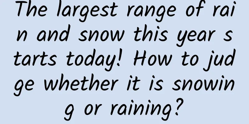
From January 20th to 24th, This year, the largest-scale rain and snow process will occur in my country. The affected areas cover more than 25 provinces. Topic #The largest range of rain and snow this year will be online# It immediately became a hot topic on Weibo. According to China Weather Network, cities such as Beijing, Shijiazhuang, Zhengzhou and Xi'an may usher in the first snowfall this year. Shi Yan, a meteorological analyst at China Weather Net, said that this round of rain and snow process is characterized by a wide range, complex precipitation phases, and long precipitation time. The affected range will involve more than 25 provinces. It is the most extensive precipitation process affecting my country this year. Image source: China Weather Network Shi Yan said that after this round of rain and snow, there will be another round of large-scale rain and snow in the central and eastern parts of the country from the 25th to the 27th, and the precipitation range will overlap with the current round of precipitation areas. Some areas in Shaanxi and Henan may have five or more days of rain and snow. After two rounds of snowfall, the local snow depth in southern Shaanxi and western Henan may exceed 20 centimeters. Many places in the south will fall into a pattern of continuous rain, and the sun will be a thing of the past. For parts of Zhejiang, Jiangsu, Guizhou, Guangxi, Hunan, Hubei and other areas, the shortage of sunlight may continue until the Lunar New Year. Everyone should take advantage of the short period of sunny weather and speed up their plans to dry clothes. Compared with rainfall forecast, snowfall forecast is much more complicated! People want to know, under the influence of the same round of strong cold air, will it be rain or snow? Can the depth of new snow accumulation be predicted? What is so difficult about snowfall forecasting? To this end, a reporter from China Meteorological News interviewed meteorological experts to find out the truth. Expert Advisor: Yang Shunan Chief Forecaster of the Central Meteorological Observatory 01 Q: What is the difference between forecasting snowfall and forecasting rainfall? First of all, it needs to be made clear that rain and snow are different phases of water, so in meteorology, snowfall forecast and rainfall forecast can be collectively referred to as precipitation forecast. We know that whether it is raining or snowing, the basic conditions for precipitation must be met, and snowfall mostly occurs in precipitation weather under the background of winter climate. Similarities: The meteorological factors such as large-scale circulation background, water vapor conditions and dynamic conditions that need to be paid attention to in rainfall forecasts are also important in snowfall forecasts. In this regard, the forecasting methods and forecasting techniques of the two are also consistent. Difference: Winter precipitation is often accompanied by the phase transformation process of rain and snow. Accurate phase forecast is the basis for snowfall and snow depth forecast, which are not included in rainfall forecast. On November 22, 2021, Changchun City, Jilin Province ushered in a new round of snowfall. Sanitation workers cleared snow on Dongzhonghua Road, Chaoyang District, Changchun City. Source: Xinhuanet When we raise our perspective to a vertical height of several thousand meters, we can find that the temperature at different altitudes in the atmosphere is not evenly distributed. At different altitudes and under different temperature and humidity conditions, the shape of precipitation particles has a variety of changes, and the precipitation phase will also undergo very complex changes. Schematic diagram of the atmospheric temperature change curve with altitude. Snowfall only occurs in the troposphere When ice crystals or snowflakes in the clouds fall down, it is like experiencing an unknown adventure. Only when the entire layer is relatively cold (for example, below 0°C) will snowflakes fall to the ground. If the temperature of the entire layer is above 0°C, it will become rain. In fact, the temperature changes between the various layers of the atmosphere are often more complicated than imagined: Case 1: If the temperature at both the upper and lower levels is below 0℃, but there is a relatively shallow warm layer in the middle, the snow at the upper level melts in the middle warm layer and then freezes again in the middle and lower cold layers, then ice particles will fall. Situation 2: If the warm layer in the middle is thicker, the snowflakes on the high layer will melt in the middle warm layer and will not have time to freeze, resulting in freezing rain. Case three: If the ground temperature is high or the snowflakes contain a lot of water, sometimes it is difficult to form obvious snow accumulation on the ground when the snow falls, but it is just a wet area. In reality, the actual vertical temperature of the atmosphere is affected by the atmospheric circulation system and complex dynamic environmental conditions, and is not so simply stratified. In addition, the surface temperature near the ground varies from cold to warm, so when and in what form will precipitation, this "naughty child", enter the public's sight? It requires complex comprehensive analysis. National precipitation forecast map released by the Central Meteorological Observatory at 6:00 on January 20, 2022 02 Q: What’s so difficult about judging whether it’s raining or snowing? Rain, sleet, snow, freezing rain, ice pellets, sleet, sleet, etc. ... Winter precipitation has various forms, and the transition between phases has a very complex mechanism, the core of which is the vertical change of temperature and water vapor in the atmosphere. Rime landscape. Image source: Tuchong Creative At first glance, there are four necessary conditions for snowfall: low temperature, saturation of water vapor, upward movement, and condensation nuclei in the air. In addition to these four conditions, the upward movement must extend to a temperature layer that is conducive to the development of ice crystals, which is usually at least -10℃. A closer look reveals that the vertical distribution of temperature and humidity in the atmosphere is very complex. The height between the -10℃ layer and the 0℃ layer, the thickness difference between relevant temperature layers, the temperature between the ground and the height at which water vapor rises and condenses, the cloud base height, as well as the path, intensity and speed of cold air, and underlying surface conditions such as topography are all key factors affecting the transition of precipitation phases. These factors restrict each other and have a non-fixed changing relationship with the formation of rain and snow phases. In short, predicting when and where it will rain or snow is a scientific and technological challenge that requires the support of three-dimensional comprehensive meteorological observation data, corresponding numerical forecasting models and objective forecasting methods. The hourly rain and snow conditions across the country reflect the evolution of precipitation Therefore, phase forecasting has always been a difficult point in winter precipitation forecasting, and there is still a long way to go to clearly explain the complex mechanisms behind this change. 03 Q: Is snow depth easy to predict? How high can 1 mm of snow accumulate? This is closely related to factors such as ice crystal structure, temperature layer and humidity layer structure, vertical movement of the atmosphere, surface temperature and snow water content. The volume ratio of air in the gaps between ice crystals determines the fluffiness of the snow. Changes in ambient temperature and humidity become determining factors in the formation, growth and final size of ice crystals. The ground temperature affects the effective amount of snow. The water content in the snow will also directly affect the depth of snow accumulation. If the water content is high, the snow will be relatively thin, and if the water content is low, the snow will be relatively thick. According to statistics, the ratio of snow depth and snowfall in my country's winter is about 0.75 cm/mm, which means that for every 1 mm of snowfall, about 0.75 cm of snow accumulation is formed. However, this ratio has a clear decreasing trend as the temperature rises, and there are significant regional differences. For example, due to the influence of surface temperature, wind force and other conditions, the amount of snow in the south is often not as much as in the north, and the amount of snow in cities is not as much as in mountainous areas. Therefore, snow forecasting requires not only paying attention to the "story" happening in the atmosphere, but also paying attention to the complex situation on the ground, which makes forecasting increasingly difficult. It can be said that snow depth forecasting is an international problem. Currently, global models such as EC (European Centre for Medium-Range Weather Forecasts) and NCEP (National Centers for Environmental Prediction) all provide snowfall forecast products, but they are all indicative in nature and differ to a certain extent from business needs. In recent years, my country has also carried out a lot of work in snow depth forecasting and gradually promoted the snow depth forecasting business. However, due to the limitations of observation data in the winter half of the year, forecasters have long had insufficient understanding of the characteristics, influencing factors and forecasting techniques of snow depth during snowfall, making snow depth forecasting still a difficult problem. FY-4A meteorological satellite true color monitoring image processed by Gao Yang and Han Bowei 04 Q: What meteorological products can the general public refer to to predict upcoming snowfall? Weather radars can show precipitation information, but compared to summer, winter precipitation is less in magnitude, so even in heavy snow (precipitation of more than 10 mm), it is rare to see strong radar echoes such as "scrambled eggs with tomatoes" on radar maps. Therefore, to understand the snowfall process, it is best to pay attention to the latest weather information released by the meteorological department. Today With the improvement of numerical forecast models Improvement of forecasting technology capabilities For the impact of rain, snow and freezing disasters Risk assessment and decision-making services It also plays a greater role in emergency response. Please be safe when traveling on snowy days! Comprehensive sources: China Meteorological News, China Weather Network, China News Service, etc. |
>>: A hero may not always ride on colorful clouds, but may ride on a small boat...


Recommend
From the perspective of employees: What are the 4 roles a CEO should play?
I wrote an article before, "Nine Characteris...
How does Snapchat survive amid competition from Facebook and other products?
Snapchat has been facing pressure from a number o...
Amazon's new wave of machine learning: powerful and actionable
[51CTO.com Quick Translation] Professional users ...
How much laughter and tears in the "Double Eleven" feast? ——Analysis of the "hidden rules" of e-commerce
Xinhua News Agency, Beijing, November 10 (Reporte...
iOS 16.6 update released, a retirement version?
iOS 16.6 Beta 2 Update This morning, Apple pushed...
China Association of Automobile Manufacturers: A brief analysis of the sales of key enterprise groups in the automobile industry from January to July 2023
According to statistics and analysis by the China...
What happened to the BeiDou-3 global satellite navigation system? What is the specific situation?
July 31, 2020 is a big day worth remembering for ...
Weibo Brand Account Social Marketing Handbook
In 2021, will we still have Weibo? When brand blu...
Tornadoes suddenly struck two places in Jiangsu, killing 10 people! How to save yourself scientifically when facing terrible "wind" risks?
On September 19, tornadoes occurred in two places...
Although it is just a combination of "white, black, red and yellow", mistaking the colors can bring fatal disasters!
Attention! There are many pictures of snakes in t...
"Bang!" It exploded! A loud noise in the early morning woke up the whole family! Many people have this thing at home
Recently, Yancheng, Jiangsu A family slept until ...
How to layout the information flow landing page? 3 tips to help you retain customers~~
In an information flow advertisement , the role o...
Why is the silver bracelet ineffective in testing poison?
Recently, a man in Yibin, Sichuan, picked mushroo...
Changsi Advertising won the "Golden Coordinate" 2014 Best Mobile Advertising Platform Award
On September 12, 2014, the 2014 Mobile Marketing ...
How to acquire customers accurately during Christmas and New Year promotions?
Christmas, New Year's Day and New Year are co...