
Does high temperature only make people emo? From a geological perspective, its contribution is not small!
|
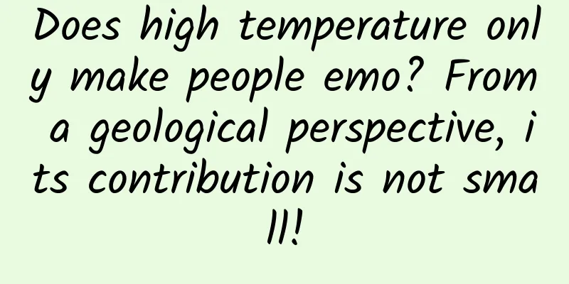
Recently, the temperature in most parts of my country has soared, and high temperature warnings have been issued in many regions. Is high temperature really useless? In fact, from a geological point of view, high temperature has made a great contribution! It will form many geological minerals and special geological phenomena. In this issue, let us take a look at the high temperature weather in the geological history period, as well as the geological minerals and special geological phenomena formed by high temperature. 01 High temperature "creates" a large amount of evaporite The most typical mineral formed by high temperature in the geological history is evaporite. Evaporite is a rock formed by chemical precipitation of high-salinity solution or brine under high temperature. Evaporite is mainly composed of chlorides (rock salt, potassium salt, etc.), sulfates (polyhalite, gypsum, etc.), nitrates (potassium, sodium, saltpeter, etc.) and borates (borax, etc.). According to the composition, it can be divided into gypsum and anhydrite rock, salt rock, and potassium-magnesium rock. Figure 1: Potash minerals (copyright image from the library, reprinting may cause copyright disputes) The Cambrian, Silurian, Devonian and Permian periods in geological history are important periods for the formation of evaporites. The geological periods for the formation of evaporites in my country are mainly the Triassic, Cretaceous, Paleogene and Neogene. Evaporites are widely used in agriculture and industry and are an important type of mineral. Common evaporite minerals include natural alkali, soda, thenardite, anhydrous thenardite, calcium thenardite, etc., among which the most common is table salt . "The fragrance of the south wind can relieve the anger of my people. The time of the south wind can enrich the wealth of my people." As early as the Yao and Shun era, in the Yuncheng Salt Lake area in southern Shanxi, China, the ancestors summarized the strong evaporation and crystallization effect brought by the south wind across the Zhongtiao Mountains to the salt lake below the mountain. Figure 2: A corner of Yuncheng Salt Lake (Source: Xinhua News Agency) The specific process is: the southeast monsoon from the ocean in summer loses all water vapor after slowly climbing over the southern foot of Zhongtiao Mountain. When the air passes over the mountain range and sinks along the leeward slope, the temperature rises due to adiabatic compression and the humidity continues to decrease, forming a dry and hot wind. The huge hot air brought by it accelerates the evaporation of water in the salt lake underfoot, causing the salt concentration of the lake water to increase and the solubility to decrease. It is finally precipitated in the form of salt crystals, allowing "our people" to have a steady supply of salt to sell. In addition to salt rock, evaporite is also a source of natural potash fertilizer. The gypsum rock formed is a good cap rock for oil and natural gas in the strata, and plays an important role in oil and gas migration, reservoir isolation and closure. It can be said that from the perspective of exploration, finding evaporite is basically not far from digging up "treasures". 02 High temperature is the prerequisite for the formation of red bed landforms There are a large number of red strata distributed from northwest to southeast my country, which are collectively referred to as red bed landforms in geology. The strata that make up these red bed landforms are mainly terrestrial red sandstone, conglomerate and shale formed in tropical or subtropical high temperature and arid environment from the Mesozoic to the early Cenozoic. The world-famous Danxia landform is essentially a set of red-bed landforms composed of sandstone and conglomerate in the Mesozoic era. The red color is the color of iron in the form of Fe2O3 in tropical or subtropical high temperature and arid environments [1]. Red bed landforms are distributed throughout my country, especially in the southeast, with the largest area in the Sichuan Basin, covering 260,000 square kilometers[2]. According to statistics, the total area of known red bed landforms in my country is 916,000 square kilometers, accounting for 9.5% of the country's land area, and is distributed in four regions: the northwest, central, eastern, and Qinghai-Tibet Plateau[2]. Figure 3: Red bed landforms in the Pingshan Lake Grand Canyon Scenic Area in Ganzhou District, Zhangye City, Gansu Province (Source: Xinhuanet) Due to the uneven hardness of the red layer landform, it is easy to form strange peaks and steep cliffs for human play, mining or carving, thus leaving behind a large amount of cultural and natural heritage. The red bed landforms have formed a large number of landforms and landscapes, becoming a beautiful business card for my country's geological tourism. The most famous of these, the Danxia landform, has become an important geological tourism resource due to its unique natural landscape and cultural connotations [3]. However, in terms of the formation of the red bed, in addition to suitable paleo-geomorphological conditions, it is also due to the large amount of leaching of other minerals in a dry and hot environment, which leads to the accumulation of a large amount of iron. (Note: Leaching is a process of soil or rock weathering, which refers to the loss of elements due to leaching by weathering and water) 03 High temperature produces unique ornamental stones Mud cracks, also known as dry cracks or cracks, are surface cracks that are wide at the top and narrow at the bottom, which are caused by the evaporation of water and volume shrinkage of sediments that have not yet solidified. Modern mud cracks are a symbol of dry and rainless climate. Mud cracks in the geological history are a more obvious and common layer structure in the ancient strata. They are the product of the alternating wet and dry environment. When the climate conditions change from humid to continuous drought, they develop on a large scale on the surface. In addition to indicating the climate, mud cracks in the strata can also indicate the location of the ancient coastline, regional stratum uplift, climate changes in temperature, dryness and wetness, shallow water exposure, etc., and play an important role in studying the changes in ancient climate and environment. Figure 4: Ripples on cracked rocks (Source: screenshot from Xiaohongshu) A large number of mud cracks developed in the red-bed landforms of the Mesoproterozoic, Cretaceous, and Triassic periods in China. Mud cracks in the strata are generally filled with cement to form mud crack stones or turtle-back stones. Some mud crack stones are eroded due to the weak weathering ability of the parent rock. The cement that fills the cracks in the sedimentary layer is retained due to its strong viscosity and harder texture, forming a window-lattice structure that resembles a network. The mud crack stones in the Mesoproterozoic strata in the Taihang Mountains of China are widely used in the decoration of screen walls, door piers, walls, and indoor exhibitions because they are often accompanied by ripples, rain marks, or other patterns and patterns. They are very practical, ornamental, and collectible. [Knowledge Expansion] In addition to geology, high temperatures can also promote forest "self-renewal" In addition to the above-mentioned mud cracks, long-term high temperatures can also cause a large number of forest fires, which objectively promotes the self-renewal of the forest. Forest fires are an important part of biological and geological evolution. They promote the renewal and replacement of forest stands, accelerate the elimination of tree species degradation, make room for the growth and development of new tree species, and improve the forest vegetation structure. In addition, forest fires can also kill parasites in the forest and inhibit the occurrence of diseases and insect pests. In short, forest fires play an important role in creating and maintaining the balance of the forest system and promoting the stable development of the forest. Frequent forest fires usually indicate higher temperatures during that geological period, while fewer forest fires indicate lower temperatures during that geological period. Scientists in my country and other parts of the world use black charcoal and charcoal records produced by forest fires in strata as indicators to study climate change in past geological periods. Of course, although from a macro perspective, forest fires also have their own geological effects, for now, we should still try to reduce the frequency of forest fires and protect precious forest resources to the maximum extent. To this end, our country has established an "air-ground-integrated" forest fire prevention network, set up a comprehensive scientific and technological intelligent fire prevention system with satellite monitoring in the sky, aircraft patrol in the air, and ground video monitoring, and comprehensively used a variety of digital high-tech means to build a complete and three-dimensional forest fire prevention network. Conclusion As far as we humans are concerned, although the current high temperatures have caused certain difficulties and discomforts to our current production and life, the high temperatures in the geological history period have also brought many rich and colorful geological mineral resources and tourism resources to humans, and promoted the optimization and adjustment of terrestrial ecology. It is an indispensable climate type and driving force for the ecological evolution of the earth. We must look at it correctly! References: [1] Zhou Cuiying, Liao Jin, Liu Zhen. Identification of red beds and its scientific research significance: from fuzzy distinction of rock surface characteristics to quantitative determination of geological genes [J/OL]. Earth Science, 1-22[2024-07-08]. [2Ding Hua, Zhao Ruixue, Shen Yi, et al. A preliminary study on the landscape characteristics, spatial distribution and protection and utilization of Danxia landforms in Northwest China[J]. Geological Review, 2023, 69 (06): 2274-2284. [3] Guo Fusheng, Ling Yuanyuan, Chen Liuqin, et al. Study on the control factors and landscape types of Danxiashan World Geopark. Modern Geology, 2023, 37 (06): 1665-1679. Author: Liu Hanbin, Senior Engineer, Shanxi Coal Geology Bureau Reviewer: Li Zhongdong, Deputy Director of Sichuan Geophysical Survey Institute, Chief Science Communication Expert of the Ministry of Natural Resources, Director of China Science Writers Association, Chief Expert of Earth Science Talent Program of Sichuan Institute of Geology and Survey Produced by: Science Popularization China |
<<: The Chinese team made its debut on the wave crest, and it turns out this is how to play surfing!


Recommend
Will you not get tuberculosis if you get the BCG vaccine? Don't be misled by these rumors
"White plague", "Nine out of ten t...
Do you think this belly button is a bit scary?
There are many strange phobias in the world, such...
What kind of mobile phones do the bosses prefer? Apple or Huawei? None of them
Which company has the best-selling mobile phone i...
An encounter ten thousand years ago stirred up a vortex in the accretion disk!
During the star formation process, an accretion d...
A highly profitable virtual product project, earning 300 yuan per order
There are more and more virtual products being so...
Tencent Weishi launches video red envelopes, which may be a very special red envelope gameplay this year
Grabbing red envelopes can be said to be the most...
How to analyze the 4 characteristics of online hot spots through user psychology
With the Internet so developed today, every hot s...
How to operate a WeChat group? Remember this 4-step process!
With the explosion of "private domain traffi...
A conversation with Wannianli CTO Luo Shilong about the programmer's brilliant transformation
[51CTO.com original article] In the Internet indu...
How much weight have you gained this Spring Festival?
Gaining weight in just seven days From New Year&#...
Aren’t non-woven bags used for takeout considered eco-friendly bags? They are also “plastic bags”?
Now, if you buy vegetables online, you can get a ...
Is drinking fruit juice really harmful?
Drinking juice is a very common thing in our dail...
Detailed explanation of Android virtual machine Dalvik and ART
Android applications are written in Java/Kotlin. ...
Use with caution! The "magic weapon" that cools down in one second is actually a "walking gas tank"
The weather is getting hotter Many car owners are...
A collection of the pitfalls you will encounter when adapting to iOS 9
[[151640]] This article mainly talks about some p...