
Unveiling the secrets of environmental satellites - satellite "eyes in the sky", protecting beautiful China for a lifetime
|
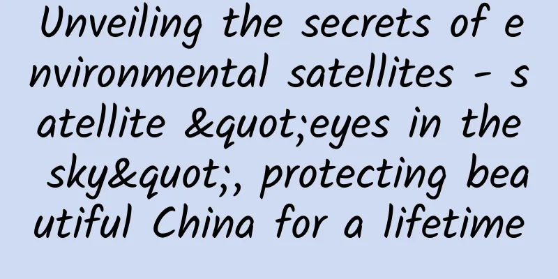
Looking down at the earth from the vast space 705 kilometers away, the "rooster" in the East is turning green. A place called Saihanba at 117° east longitude and 42° north latitude has changed from a piece of withered yellow wrinkles to a green ribbon. With its sharp eyes and ears, it can not only monitor changes in the ecological environment, but also sense every change in a street, a city, or a mountain. The information captured by its "eyes" and "ears" is transmitted to the ground receiving station through images and signals, and is applied in fields such as ecological environment. … It is the ecological environment satellite. At 6:53 on October 13, 2022, at the Taiyuan Satellite Launch Center, the Long March 2C carrier rocket successfully launched the Environmental Satellite 2E into the planned orbit, and the launch mission was a complete success. So far, the ecological and environmental satellites organized by the Ministry of Ecology and Environment for development, construction and normal operation in orbit are composed of five "brothers and sisters", namely "Environment Satellite 2A, B, E", "Hyperspectral Observation Satellite" and "Atmospheric Environment Monitoring Satellite". From demonstration to project establishment, from design to research and development, from manufacturing to launch, from payload startup to data transmission, from in-orbit testing to satellite delivery, every step they have taken is a leap from "0" to "1". Every component of them is full of stories, and it also helps the ecological environment industry to achieve a leap-forward improvement in quantitative remote sensing monitoring service capabilities, and provides strong support for our country to achieve synergistic efficiency in pollution reduction and carbon reduction and build a beautiful China. A big deal Green waters meander, green mountains face each other, vegetation is lush, flowers and birds are neighbors, green can be seen when you open the window, blue sky and white clouds can be seen when you look up during the day, and twinkling stars can be seen at night. This kind of pastoral poetry embodies people's common yearning and pursuit for a green and beautiful life. With the rapid development of my country's economy, environmental issues have attracted more and more attention from people, and the tasks of environmental monitoring have become increasingly heavy and the requirements have become increasingly high. In terms of monitoring scale, we should not only pay attention to environmental and ecological changes at the regional scale, but also pay attention to climate change at the global scale; in terms of monitoring content, the number of monitoring elements is also increasing. So, how can we comprehensively monitor my country's ecological environment, keep the "green waters and green mountains" intact, and ensure harmonious coexistence between man and nature? Satellite remote sensing technology plays a pivotal role. As a new monitoring method for ecological and environmental protection in the new era, satellite remote sensing monitoring will greatly improve my country's ecological and environmental protection governance capabilities. During the interview, You Dai'an, deputy director of the Ecological and Environmental Space Data Center of the Satellite Environmental Application Center of the Ministry of Ecology and Environment and director of the Institute of Ecological and Environmental Satellite Development, told Environmental Economy that at present, the global space infrastructure has entered a new stage of systematic development and global services, and satellite remote sensing has developed towards the direction of overall observation of the earth and collaborative observation of multiple satellite networks, and has gradually formed a global comprehensive observation capability combining three-dimensional, multi-dimensional, high, medium and low resolutions. Image of the hyperspectral observation satellite launching and igniting. Provided by Teng Jiahua You Daian further explained to reporters that satellite remote sensing has the advantages of large observation range, high timeliness, and quantification, and is playing an increasingly important role in remote sensing monitoring of the ecological environment. It is reported that remote sensing monitoring of the ecological environment has the characteristics of macroscopic, rapid, quantitative and accurate. After more than 50 years of rapid development, it has developed from visible light to the full spectrum, and evolved from traditional optical imaging to a comprehensive observation technology combining optics and microwaves, and active and passive collaboration. The spatial, spectral, radiation and temporal resolutions continue to improve. Relying on the huge advantages of large-scale, all-weather, all-day and periodic monitoring of global environmental changes, it has become the most feasible and effective technical means to monitor the dynamic changes of the macro ecological environment. In recent years, my country's ecological environment satellite remote sensing monitoring capabilities have steadily increased. The ecological environment satellites in orbit have strong remote sensing monitoring capabilities in atmospheric environment monitoring, water ecological environment monitoring, natural ecology monitoring, etc. The replacement rate of domestic satellite remote sensing data has reached more than 90%, effectively solving the dependence on foreign remote sensing data and playing an increasingly important role in ecological environment remote sensing monitoring. At the same time, You Daian has a clear understanding of my country's current ecological environment satellite monitoring capabilities and applications. "At present, in order to better meet my country's ecological environment monitoring business needs, support ecological civilization construction, and fight hard to prevent and control pollution and other national strategies, it is urgent to establish my country's independent and controllable ecological environment satellite system." Birth Road The appearance of a satellite is like a big bird with its wings spread, soaring in the sky. The birth of a satellite is a process in which many parts are assembled into a complete satellite. Teng Jiahua, an engineer at the Satellite Environmental Application Center of the Ministry of Ecology and Environment, told reporters that satellite projects are generally composed of six major systems, namely satellite systems, launch vehicle systems, launch site systems, measurement and control systems, ground systems and application systems. The birth of an ecological environment satellite needs to go through stages such as project feasibility study, plan, prototype (research satellite), final prototype, in-orbit test and evaluation, and delivery and operation. Photo provided by Teng Jiahua. In the process of converting needs into satellite "components", user departments are required to propose all usage requirements for satellite monitoring, classify the needs, and sort out the types of detection elements and satellite detection indicator requirements. Subsequently, the satellite development department designs a suitable satellite orbit based on user requirements, proposes corresponding detection methods and payloads, and selects a suitable satellite platform based on the volume, weight, power consumption, etc. of the payload, forms an overall satellite design plan, and carries out the development and construction of "components" according to the plan. You Daian told reporters that after the ecological environment satellite is developed, it will be transported to the satellite launch base. Photo provided by Teng Jiahua. Subsequently, the launch vehicle for the ecological environment satellite also arrived at the launch base simultaneously. After the base test, the ecological environment satellite will dock with the rocket to form a satellite-rocket combination. After the expert review, when it is considered that the launch conditions are met, the rocket and the satellite are transported to the designated launch station together. With the countdown of 5, 4, 3, 2, 1, "Ignition"! At the command, the rocket on the tower soared into the sky in a huge flame, carrying the ecological environment satellite straight into the sky. After a period of time, when they arrive at the predetermined orbital entry point, the satellite and the rocket separate. Then, the ecological environment satellite will undergo a series of control and testing work and can start normal work. "The entire process of an ecological environment satellite, from project feasibility study to data transmission, generally takes 6 to 8 years. It is like raising your own child, from a hungry baby to a spirited young adult. Watching it successfully enter orbit, the mood can be said to be mixed, full of reluctance but also deep pride and relief." You Dai'an said with emotion. Special features my country's civil satellites can be divided into four major systems: meteorological satellites, resource satellites, ocean satellites and environmental satellites. Compared with other series, environmental satellites started later but have developed faster. In 2008, the Environment 1A and B satellites were successfully launched. In 2012, the Environment 1C satellite was launched into space. The three small satellites, Environment 1A, B and C, were networked and operated. The Environment 1 satellite environmental application system was built and initially realized commercial operation, marking that my country's environmental monitoring has the help of the "Sky Eye". In September 2020, the Environmental 2A and B satellites were successfully launched with one rocket, replacing the Environmental Disaster Reduction 1A and B satellites that have been in orbit for 12 years, and continue to serve the major application needs of the country's ecological and environmental protection work. In September 2021, the hyperspectral observation satellite was successfully launched. Its in-orbit operation effectively filled the gap in my country's hyperspectral satellite remote sensing observations and greatly increased the localization rate of hyperspectral remote sensing observation data, marking that my country's hyperspectral satellite remote sensing has initially achieved operational application in the field of ecological environment. The satellite can conduct comprehensive monitoring of the land surface and atmospheric environment, providing hyperspectral satellite remote sensing data guarantee for my country's main ecological and environmental protection business. On April 16, 2022, the atmospheric environment monitoring satellite was successfully sent into the predetermined orbit and networked with the "Hyperspectral Observation Satellite", further increasing the frequency of remote sensing observations of my country's atmospheric environment, improving revisit capabilities and global coverage capabilities, and greatly enhancing my country's quantitative remote sensing service capabilities in multiple fields such as ecological environment, meteorology, and agriculture. It effectively solved the dependence on foreign remote sensing data, and is of great significance to promoting ecological and environmental protection. At the same time, You Dai'an said that in carrying out remote sensing monitoring of the ecological environment, ecological environment satellites are the undisputed main force, but other domestic satellite series such as Gaofen, Fengyun, Resources, Ocean, and even foreign satellite series such as Sentinel, Land Resources, and Sunflower, are also important data sources. Only when various types of data are used in a coordinated manner can we effectively support the actual needs of ecological and environmental protection work. So, what is so special about ecological environment satellites compared to other series of satellites? In this regard, You Dai'an introduced to reporters in detail that, first, ecological environment satellite detection has many elements, from sky to earth to sea, the atmosphere, land and ocean all need to be observed, and the requirements for comprehensive observation are relatively high. Secondly, the quantification requirements are high. Not only the geometric quantitative information of the observed target is needed, but also the ability to obtain the target composition information (radiation quantification) is required to be higher. In other words, it is necessary not only to be "visible" but also to be "distinguished". Therefore, there are high requirements for radiation accuracy and spectral resolution. Third, there is a high requirement for timeliness, especially in business applications such as the central ecological and environmental protection inspection, ecological and environmental law enforcement, and environmental emergency monitoring. It is necessary to quickly obtain effective data in the monitoring area and quickly respond to monitoring task requirements. Multiple loads For many people, satellites are "high-end" and have always been relatively mysterious. You Dai'an told reporters that this is not the case. Satellites are very "dumb" things. They can only orbit the earth in a fixed orbit designed in advance by designers, and they are not completely "high-tech". In fact, the seemingly "high-end" functions of satellites are mainly realized by the detection instruments (payloads) they carry. The Environmental Satellites No. 2A and No. 2B have powerful multi-spectral, hyperspectral, infrared and other ground remote sensing imaging capabilities and atmospheric synchronous detection capabilities. They are equipped with four types of optical payloads, including a 16-meter optical camera, a hyperspectral imager, an infrared camera, and an atmospheric corrector. Among them, the 16-meter optical camera is composed of four visible light CCD cameras, which can provide multi-spectral images with a width of 800 kilometers through field of view stitching; the hyperspectral imager has a width of 96 kilometers and can achieve ground observations in more than 200 spectral bands, which is equivalent to taking more than 200 photos of the surface at the same time using different spectral bands; the infrared camera has a width of 720 kilometers and can achieve multi-spectral infrared imaging such as near-infrared, short-wave infrared, mid-infrared, and thermal infrared; the atmospheric corrector can synchronously obtain atmospheric multi-spectral information with the same field of view as the 16-meter optical camera on orbit, which is used to assist in the atmospheric radiation correction of the subsequent processing of the 16-meter data. The hyperspectral observation satellite has realized the integrated application of multiple observation data such as hyperspectral, full spectrum, polarization, multi-angle, and flare on the same satellite. The highest imaging spectral resolution reaches 2.5 nanometers and the width is 60 kilometers; the highest atmospheric detection spectral resolution reaches 0.03 nanometers, the polarization detection accuracy is better than 0.5%, and the observation angles reach 15. The comprehensive performance indicators have reached the international advanced level. The hyperspectral observation satellite is equipped with a total of 7 detection instruments, covering the spectrum from ultraviolet to long-wave infrared. It integrates imaging technology and hyperspectral detection technology, and can realize comprehensive observation of spatial information, spectral information and radiation information. "Two land surface imagers and five atmospheric composition detectors are integrated into this small 'body', making this satellite a well-deserved 'all-rounder'," said Teng Jiahua with emotion. The two land surface imagers - the visible shortwave infrared hyperspectral camera (AHSI) and the full-spectrum spectral imager (VIMI) - can monitor land and water environmental elements with high precision, including water pollutant concentrations, water thermal pollution, urban heat islands, biodiversity, etc. They can be used for natural ecological monitoring, key lake and reservoir water quality monitoring, mineral resource exploration, urban heat island effect monitoring, disaster risk monitoring, typical glacier groups and background snow monitoring, agricultural and forestry fine remote sensing, etc., providing strong support for my country's ecological protection red line supervision, clear water protection battle and clean land protection battle. Among the five atmospheric composition detectors, the atmospheric aerosol multi-angle polarization detector, high-precision polarization scanner and absorptive aerosol detector are all atmospheric aerosol detectors, which can be used for PM2.5 and haze monitoring, helping to win the battle to protect blue skies. After entering orbit, the atmospheric trace gas differential absorption spectrometer and the atmospheric main greenhouse gas monitor will become the only available hyperspectral pollutant gas and greenhouse gas monitoring payloads. The atmospheric trace gas differential absorption spectrometer has a 0.5-nanometer ultraviolet hyperspectral detection method, which can monitor global pollutant gas conditions on a daily basis, serving my country's "atmospheric pollution prevention and control" and "ozone and PM2.5 coordinated detection" work. The atmospheric main greenhouse gas monitor can achieve 1~4ppm carbon dioxide detection and 20ppb methane detection, making carbon emissions nowhere to hide. "Simply put, hyperspectral observation satellites will see richer details, more precise components, more powerful functions, higher time efficiency, wider spatial coverage, and more accurate observation data." You Dai'an told reporters that no matter whether it is straw burning, illegal emissions, or environmental problems such as surface damage and oil spills on the sea, nothing can escape its "eagle eyes." The atmospheric environment monitoring satellite is designed to operate in a sun-synchronous orbit of 705 kilometers. It is equipped with five remote sensing instruments, including an atmospheric detection lidar, a high-precision polarization scanner, a multi-angle polarization imager, an ultraviolet hyperspectral atmospheric composition detector, and a wide-band imaging spectrometer. Regarding the remote sensing instruments on board, You Dai'an gave an example, saying that it is equivalent to five passengers forming a "space car". Each of them holds various measuring instruments to conduct continuous and dynamic comprehensive monitoring of ecological and environmental elements such as atmospheric fine particulate matter, greenhouse gases, gaseous pollutants, clouds and aerosols, as well as water environment. Photo provided by Teng Jiahua. "Especially the 'distinguished guest', the atmospheric sounding lidar, places very high demands on the driving skills of the special car drivers." Liu Sihan, chief expert in satellite engineering at the Satellite Environmental Application Center of the Ministry of Ecology and Environment, said that when the atmospheric sounding lidar is working, it emits lasers of different bands to the ground in real time and receives the laser echo signals. By inverting the received echo signals, it can invert the global atmospheric carbon dioxide column concentration information and the vertical distribution information of clouds and aerosols. More importantly, it can achieve high-precision detection of the global atmospheric carbon dioxide column concentration. Liu Sihan further explained that the traditional passive remote sensing satellites generally have an accuracy of 2~4ppm for CO2 detection and can only observe during the day. They are also greatly affected by clouds and aerosols, and the data efficiency is generally around 10%. Active laser means can achieve all-day detection, and the laser spot is relatively small, which can pass through thin clouds and broken clouds and is less affected by aerosols. The data efficiency can reach about 60%, and the detection accuracy is better than 1ppm. "Using the above-mentioned changing characteristics, we can very sensitively capture the changes in these components in the atmosphere. The atmospheric detection lidar is not affected by day or night and can observe around the clock, so it can be said to be a conscientious 'model worker'. At the same time, it is not affected by latitude bands and can conduct global observations to obtain more effective high-precision carbon dioxide observation data." Liu Sihan said. It is not difficult to see that the perspective of ecological environmental protection is not limited to the mountains, rivers, lakes and oceans that can be seen. From scratch to the pursuit of high-quality development, my country's ecological environmental satellite technology research is also developing in the direction of high observation capabilities and high data quality. Different tasks Looking up, there are numerous ecological and environmental satellites in the sky. Could their functions be overlapping? "Each satellite has a different main mission." You Dai'an told reporters that there is no need to worry about having too many satellites. The more satellites in orbit, the more networking can be achieved, which can greatly improve data acquisition and coverage capabilities and revisit performance. On the other hand, different satellites can also play a complementary role. You Daian further explained that "the image data from the three satellites, Huanhuan-2A, B and E, are widely used in environmental monitoring and supervision, and are extremely important for improving the business capabilities of ecological environment remote sensing monitoring." In terms of remote sensing monitoring of the atmospheric environment, dynamic remote sensing monitoring of straw burning and dust pollution can be carried out to realize the application of refined remote sensing monitoring of atmospheric environmental pollution, and provide technical support for atmospheric pollution prevention and control as well as early warning and forecast of air environment quality. In terms of remote sensing monitoring of water environment, dynamic monitoring can be carried out on water quality parameters such as chlorophyll a and suspended solids, offshore environmental events such as oil spills and red tides, and thermal pollution of water bodies such as warm discharge from nuclear power plants and thermal power plants. In terms of ecological and environmental monitoring, it can provide important data support for core ecological management businesses such as ecosystem monitoring and assessment, production of key ecological and environmental parameters, comprehensive supervision of nature reserves, monitoring and assessment of mineral resource development, and ecological and environmental monitoring of urban agglomerations, and realize the commercial operation of ecological and environmental information extraction, analysis and comprehensive application. Similarly, hyperspectral observation satellites are also providing important data support for monitoring the atmosphere, water, natural ecology, etc., but there are still differences between them and the Environment No. 2A and B satellites. You Daian introduced in detail that hyperspectral observation satellites can conduct remote sensing monitoring of fine particulate matter, dust, polluted gases, greenhouse gases, etc. in the field of atmospheric environment remote sensing monitoring, realize refined remote sensing monitoring applications of atmospheric environmental pollution, provide technical support for atmospheric pollution prevention and control and air environment quality early warning and forecasting, and help achieve the "dual carbon" goals. In terms of remote sensing monitoring of water environment, dynamic monitoring of water chlorophyll a, suspended matter, transparency, eutrophication index, water temperature, etc. can be carried out. In terms of natural ecological monitoring, it can provide important data support for monitoring of ecological protection red lines, nature reserves, urban ecological environment, mining environmental development, biodiversity, etc. It is worth mentioning that in terms of biodiversity monitoring, hyperspectral observation satellites can play a pivotal role. This is mainly reflected in the refined monitoring of ecosystems and species habitats. Compared with previous multispectral satellites, the hyperspectral and full-spectral information obtained on this satellite can improve the accuracy of identifying ecosystem types, the distribution and health status of important species habitats or habitats. Taking the giant panda as an example, with the help of this satellite, we can observe the living environment of the giant panda, such as the types of bamboo, water, heat and nutritional status. In addition, speaking of the atmospheric environment monitoring satellite that was successfully launched not long ago, You Daian happily told reporters that the satellite platform and various remote sensing instruments are working normally. It is still in the in-orbit testing stage, but a large amount of high-precision remote sensing data has been acquired and a large number of high-precision application products have been generated. Regarding global carbon monitoring, the atmospheric environment monitoring satellite has achieved three international firsts. It has obtained global CO2 column concentration data with an accuracy better than 1 ppm for the first time, obtained global CO2 column concentration data at night for the first time, and obtained CO2 column concentration data at the North and South Poles. The effective data rate reached 60% (passive data is generally around 10%). Through cross-comparison with other satellites and ground stations, the application effect has reached the international leading level. Atmospheric environment monitoring satellites can also obtain CO2 column concentration data in key areas of Europe and the United States in a short period of time, which will help my country to take the initiative and voice in carbon diplomacy, which is impossible for us to do through ground monitoring. For air pollution monitoring, the atmospheric environment monitoring satellite has obtained global high-precision aerosol profile data for the first time in the world, and has obtained near-ground fine particulate matter mass concentration data through a combination of active and passive remote sensing methods for the first time in the world, providing high-precision remote sensing data support for my country's air pollution control. Through the coordinated use of multiple satellites in a network, the ecological and environmental satellite has significantly enhanced my country's application capabilities in comprehensive monitoring of the atmospheric environment and global climate change after its in-orbit application. It is of great significance to improving the comprehensive application efficiency of ecological and environmental satellite resources and promoting the cause of ecological and environmental protection. All in one picture Jiawang District, Xuzhou City, Jiangsu Province, used to be "half of the city was coal ash and half of the city was soil", but now it is "half of the city is green mountains and half of the city is lakes". Satellites have recorded the changes in the ecological environment in Jiawang District over the past 10 years: the barren mountains and abandoned mines have been covered with new green, effectively improving the ecological environment and eliminating the hidden dangers of geological disasters; the saplings planted in the cracks of the rocks in Dadong Mountain have grown into a forest, becoming a green oxygen bar pursued by citizens... These changes are full of the beauty of natural ecology. "Photographic examination" is one of the important tasks of ecological environment satellites. Teng Jiahua told reporters that ecological environment satellites work in two ways. The first is the continuous observation mode. When the satellite is in orbit, all remote sensing instruments work continuously. The passive visible light payload automatically switches between observation and standby according to the day and night of the sub-satellite point. The active laser and infrared payloads observe continuously and uninterruptedly. The satellite transmits all observation data back to the ground. This working mode is generally suitable for atmospheric observation and has global observation capabilities. The second is customized observation mode. The user formulates the observation task (including observation time and observation area), and the ground sends instructions to the satellite. After receiving the instructions, the satellite starts to perform the observation task when the orbit reaches the corresponding position, obtains remote sensing data of the mission area, and transmits it back to the ground. This method is generally suitable for surface observation, mainly for my country. They are so far away from us, can they clearly distinguish all the objects on the ground? You Daian explained that satellite data is actually transmitted to the data receiving system of the satellite ground receiving station through the data transmission antenna on the satellite. After radiation processing, geometric correction and other processing processes, 1~2 level primary data products are generated, and finally transmitted to the application system for the production of advanced topics and application products. "Different elements and their compounds on the earth have their own unique spectral characteristics. The spectrum is therefore regarded as the 'fingerprint' for identifying substances and is an important 'identity card' for analyzing the characteristics of different objects." Teng Jiahua said that hyperspectral cameras, for example, can more accurately detect the spectral characteristics of surface objects and identify the characteristics of objects. For example, if a field of wheat is planted somewhere, professionals can infer that it is a crop-planting plot based on previous images taken by ecological and environmental satellites, but cannot tell whether it is wheat or rice. However, with the help of spectral information detected by hyperspectral observation satellites, professionals can quickly determine the type of crops planted. You Daian told reporters that the ecological environment satellite will obtain a huge amount of data when it is in orbit. This requires technicians to first perform model inversion on the data, perform calculations and analysis through inversion algorithms, and then produce application products to obtain results to serve various work and life. "To put it in an analogy, the data we obtain through satellite remote sensing is like ingredients, and the specific application products developed by each user are like dishes. Only when the 'dish' is well prepared can the value of these 'ingredients' be reflected," said You Dai'an. One cannot help but sigh, "With a map in hand, you can know all the elements." Gazing thousands of miles away, we can collect a large amount of ecological and environmental information and see the beautiful mountains and rivers of our motherland. Blooming Satellites have a lifespan of only a few years, and they will die when their fuel is exhausted. At present, the lifespans of the ecological environment satellites "brothers and sisters" in orbit and in normal operation are different. Environment-2A and Environment-2B satellites adopt a sun-synchronous return orbit. The two satellites have the same technical status and a design lifespan of 5 years. The design lifespans of the hyperspectral observation satellite, the atmospheric environment monitoring satellite, and Environment-2E satellite are 8 years, and they are three "long-life satellites". Ecological and environmental satellites orbit the earth in orbit, experiencing more than ten changes in high and low temperatures and the impact of space radiation every day, which is a great test for the satellite's service life. It is reported that "long life" requires satellites to adopt high-reliability designs in terms of space environmental effects, the number of rotations of active parts, consumable raw materials, etc. In order to master the "longevity gene" of high-orbit remote sensing satellites, the researchers have devoted themselves to research and comprehensively promote the "longevity" of ecological environment satellites. Taking the hyperspectral observation satellite as an example, researchers have inherited the existing mature design schemes, carried out scheme optimization design for each weak link in the life span, taken improvement measures, tightened product process testing and control, and carried out high-temperature accelerated life tests. The cumulative power-on time under high temperature conditions of +55°C exceeds 4,000 hours, and its equivalent on-orbit life can be more than 10 years. Where do ecological and environmental satellites go after they have completed their missions and reached the end of their lifespan? You Dai'an told reporters that in order to save precious orbital resources and to prevent threats to other spacecraft working normally in orbit and future launches, satellites can be decommissioned or deorbited after their lifespan expires. Regarding deorbiting, You Daian further explained: "When the ecological environment satellite reaches the end of its life, according to international conventions, its orbit must be lowered. As the system ages, the orbit will get lower and lower, and it will slowly fall down at some point. When it falls, it may enter the atmosphere and burn up." "The vast sky herds the stars, separates light and identifies objects without leaving a trace." Throughout its life, the ecological and environmental satellite has made significant contributions to the implementation of "precise pollution control, scientific pollution control, and pollution control in accordance with the law", supporting the in-depth fight against pollution and achieving synergistic efficiency in pollution reduction and carbon reduction. |
<<: A look at some of the weirdest scientific research in 2022


Recommend
iOS vs Android: Will Apple repeat the mistakes of its PC business?
Since its birth, the iPhone has attracted countle...
"Blacklist" of daily chemical ingredients: Be careful with skin care products and cosmetics containing these ingredients!
Every time I post product reviews on skincare, co...
Guangzhou WeChat legal consultation mini program function, how much does it cost to make a legal consultation mini program?
With the continuous improvement of the rule of law...
Can gray hair turn black again? The doctor's answer is unexpected
I believe that not many people like their gray ha...
Subsidies for new energy vehicles are withdrawn, and the income from point trading is only 1/10 of the subsidies
How can enterprises bear the high costs after the...
The most comprehensive online and offline promotion guide for mini programs!
As mini programs become more and more sophisticat...
"Air-to-Air Power-On" Race: China's Aviation Industry Enters the Era of Air-to-Air Internet Access
The first portable electronic device (PED) open f...
Hunan Satellite TV takes back the video broadcasting rights: digging a hole for itself?
On May 8, Hunan TV announced that it would no lon...
I spent 20,000 yuan, why is there not a single conversion?
“I know that half the money I spend on advertisin...
Why mobile game developers need to take piracy seriously
By now, almost everyone in the mobile space has h...
Mutual Finance and Credit "High Cost-Effectiveness" User Growth Method (Routine)
The cost of acquiring customers in the Internet f...
Douyin Must-Hit Academy·Food Addiction-Group Buying Expert Practical Course, teach you how to become a group buying store explorer with zero basic knowledge
Douyin must-be-hot academy·Fan Shangyou-Group buy...
The Ultimate Guide to Creating and Publishing Android Libraries
I am often amazed by the number of useful third-p...
How romantic are astronomers? Come and see those shining "Chinese stars"
Your browser does not support the video tag Your ...
From 0 to 120,000 community users, the practical methodology of a 5-year operation veteran
Today, the editor invited a senior community oper...