
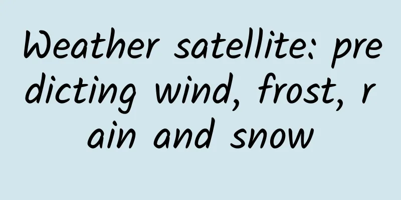
Weather satellite: predicting wind, frost, rain and snow
|
Among all kinds of satellites, there are some that we use every day, and meteorological satellites are one of them. Now humans are accustomed to living with weather forecasts. Without meteorological satellites, our daily lives will face great troubles. In theory, a meteorological satellite is a type of earth observation satellite, but its main observation object is not the ground, but the thin atmosphere. The main weather activities faced by humans, including wind, frost, rain and snow, are all in the atmosphere. By observing the changes in parameters such as temperature in the atmosphere and water content in the clouds, we can have a full understanding of atmospheric activities. Not only can we make short-term weather forecasts, but we can also summarize the movement laws of the entire earth's atmosphere, providing an important basis for medium- and long-term weather forecasts and global climate change research. Weather Satellite ABC Specifically, meteorological satellites are mainly responsible for the following tasks: taking satellite cloud images, studying the parameters inside the clouds, detecting the surface conditions of land and ocean, detecting the water content and precipitation data in the atmosphere, detecting the content and distribution of ozone in the atmosphere, detecting the impact of solar radiation on the earth and the earth's infrared radiation to the universe, and detecting the space environment. If meteorological satellites are distinguished by their orbits, there are generally two types, namely polar-orbiting meteorological satellites and geostationary meteorological satellites. Geostationary satellites are of course deployed in geostationary orbits. Their main advantage is that they can continuously observe about 1/3 of the earth's surface, with high temporal resolution, but relatively poor spatial resolution. The other type is polar-orbiting meteorological satellites, which operate in a sun-synchronous orbit, that is, the orbital inclination is between 97 and 98 degrees, and the altitude is generally between 700 and 800 kilometers. The spatial resolution of this type of satellite is relatively high, but the temporal resolution is slightly worse. It may take several days to re-observe the same area. Therefore, in international weather forecasts, these two types of satellites will work together. There are many types of payloads on meteorological satellites, but they can be roughly divided into two types: imaging remote sensors and atmospheric probes. There are three main types of imaging remote sensors: scanning radiometers, medium-resolution imaging spectrometers, and microwave imagers. Atmospheric probes mainly include infrared spectrometers, microwave thermometers, and microwave hygrometers. The satellite cloud images we often see in weather forecasts are mainly taken by scanning radiometers. In the process of applying navigation satellites, people have also discovered another interesting thing: the transmission of navigation satellite signals in the atmosphere is also directly related to the state of the atmosphere, such as the water content of the atmosphere, etc. By detecting changes in navigation signals, the atmospheric conditions in the area can be sensed. Therefore, a new type of meteorological satellite has emerged today, which uses low-orbit constellations to monitor changes in global GPS signals or Beidou navigation satellite signals to form accurate weather forecast data. The rise of China's meteorological satellites In the field of meteorological satellites, China has experienced a rapid rise. Before the 1980s, China was in a blank state in the field of meteorological satellites. Since the mid-1980s, China has actively invested in the development of meteorological satellites. On September 7, 1988, China launched its first meteorological satellite, the Fengyun-1 sun-synchronous orbit meteorological satellite. A total of two first-generation Fengyun-1 satellites were launched, but because China had insufficient experience in meteorological satellites at the time, the two satellites lost their functions after a short period of operation. The first color composite image of Fengyun-1A on September 7, 1988 During the development of the Fengyun-2 geostationary meteorological satellite, an accident occurred before the launch of the first satellite, resulting in damage to the satellite. However, as the saying goes, there is no rainbow without wind and rain. After more than 20 years of hard work, China's meteorological satellite industry has made great progress. Today, the new generation of Fengyun-3 and Fengyun-4 meteorological satellites are responsible for the main observation mission in space. By July 2022, China will have a total of 7 meteorological satellites in orbit, including 4 geostationary orbit satellites and 3 sun-synchronous orbit satellites. Fengyun-3E also operates in a very special orbit, that is, the morning-dusk orbit. It flies along the earth's morning-dusk line, and each time it flies over the same place, it is around 6 a.m. local time, and it arrives at the other side of the earth at dusk. Fengyun-3E is the world's first morning-dusk orbit satellite. This satellite is networked with Fengyun-3C and Fengyun-3D, making China the only country in the world that has the ability to network and observe meteorological satellites in three orbits: morning, afternoon, and morning-dusk. According to the National Meteorological Administration, "At present, my country's Fengyun meteorological satellites have reached the advanced level of similar international satellites. They have been listed in the international meteorological operational satellite sequence by the World Meteorological Organization and have become an important member of the global integrated earth observation system. They are also the duty satellites of the International Disaster Charter mechanism, providing satellite data and products to more than 80 countries and regions around the world and more than 2,500 users in China. my country's Fengyun series meteorological satellites are in a three-legged race with the US (Japanese) meteorological satellites and the European meteorological satellites. The weather forecast in the Eastern Hemisphere mainly relies on the relevant data provided by my country's meteorological satellites." In 2018, the International Meteorological Satellite Organization took the initiative to request the Chinese Satellite Meteorological Department to move the Fengyun-2H satellite to 79 degrees east longitude over the Indian Ocean to fill the gap in satellite observations of the Indian Ocean and the African continent. Currently, Fengyun-2H is still operating there. China has also developed a satellite that uses navigation satellite signals to detect weather, namely Feng-1A/B. This satellite can detect navigation satellite signals reflected from the sea surface. Ocean waves are mainly caused by sea breezes. Changes in ocean waves will inevitably cause changes in reflected navigation signals, so through inversion, specific data on ocean breezes can be obtained, including wind force and direction. If a multi-satellite network can be realized, accurate forecasts of extreme typhoon weather can be made. Other applications of meteorological satellites Meteorological satellites can not only observe weather, but also be used to implement some unplanned work. In the late 1990s, China's remote sensing department used meteorological satellite data to observe snow conditions around the world, with good results. Schematic diagram of Fengyun-4 satellite There is another very important innovation in the application of Chinese meteorological satellites, that is, crop yield estimation. Meteorological satellites can not only observe meteorological conditions, but also observe the growth of ground vegetation over a large area. By integrating information from multiple disciplines such as agriculture, meteorology, hydrology, and geology, it is possible to predict how much grain or cash crops a certain agricultural area can produce in that year, and provide a basis for decision-making for relevant national departments and large agricultural enterprises. This work has been widely carried out in China since the beginning of the 21st century and has achieved important results. Today, the use of meteorological satellites for crop yield estimation has become a daily task for agricultural management departments, and has played a very important role in ensuring the food and vegetable baskets of the Chinese people. (Author: Chi Huo) |
<<: Is the sound heard in the conch the sound of the ocean?
>>: "Praising" is good for your health, so you must do it more often!


Recommend
3 steps to complete operational data reporting
This article will allow you to operate effortless...
Using pointers in Swift
Apple hopes to minimize the appearance of pointer...
I spent 600 yuan in the morning and didn’t get any conversations, but my creative idea had a high click-through rate. How can I solve this problem?
Recently, I have received many messages from frie...
Song Zhiming's "Long and Difficult Sentences Skill Analysis Class"
Course Catalog ├──Analysis of Long and Difficult S...
Emei School Guo Xiang anchor online training course, valued at 299 yuan
The course comes from the online training course ...
Revealing the 315 hacker wifi, how to ensure APP data security?
The 315 Party exposed WIFI security, demonstrated...
App promotion: preparation before listing on app stores and other promotion channels!
After the App is developed, promoting the App nat...
From breaking the technology monopoly to overtaking others, the logic of China's development of electric vehicles is related to the rise of national fortunes
Industrial competition between China and the Unit...
Can multi-screen interaction on smart TVs really improve user experience?
Multi-screen interaction centered on TV has gradu...
The 2023 Nobel Prize in Physics has been announced! Learn about the history of attosecond pulses
The 2023 Nobel Prize in Physics was awarded to th...
150 million years ago, this oldest bird rewrote the history of bird evolution! What is the relationship between dinosaurs and birds?
Recently, a bird fossil named Baminornis zhenghen...
Do you have the same stutter as Shen Gongbao? The doctor teaches you how to speak smoothly from "stuttering"
The domestic animated film "Nezha: The Devil...
Can drinking yogurt protect against computer radiation? Don’t exaggerate the claim…
Ruan Guangfeng Yogurt tastes sweet and sour and i...
Teacher Zhenhong's Ultimate Course: How I Make Money from Stock Trading, Make Stock Trading a Money-Making Skill
Teacher Zhenhong's Ultimate Course: How I Mak...
Key staff members resigned in a rush, causing Coocaa to face a crisis of evaporation of soft power
"One million units is a watershed for TV manu...