
Mount Emei, the other side you don’t know
|
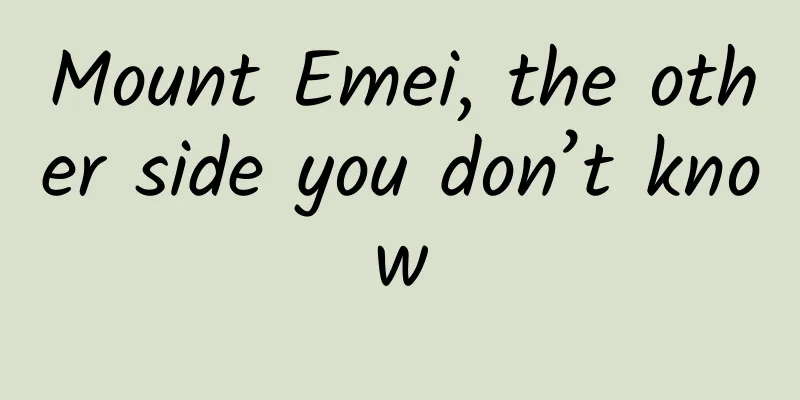
Mount Emei is one of the four famous Buddhist mountains in my country and a famous place for the practice of Samantabhadra Bodhisattva. In 1996, Mount Emei was listed as a World Heritage Site together with the adjacent Leshan Giant Buddha for its outstanding natural and cultural value, becoming one of the few natural and cultural dual heritage sites in the world. Mount Emei, which is high in the clouds, not only has a good ecological environment and numerous palaces and temples, but also has many unknown sides... ▲Mount Emei. Source: Tuchong Creative 01 She is a table-shaped mountain In May 2015, I and Mr. Shan Zhiqiang from China National Geographic came to Leshan, Meishan and Ya'an on the southwestern edge of the Sichuan Basin. The purpose of this trip was to investigate the three unique mountains: Dawa Mountain, Wawu Mountain and Emei Mountain. We arrived at Mount Emei in the afternoon, and we traveled through clouds and fog all the way. When we reached the Golden Summit, it was even more foggy, with rain and snow flying everywhere. The next morning, the expected sea of clouds and sunrise still did not appear, but the fog had mostly dissipated. We arrived at the Golden Summit and stood on the observation deck to look at the Wanfo Peak in the distance. We saw the cliffs of the Wanfo Peak soaring into the sky, and the flat fields rising up, like a desk suspended in the clouds. This is the table-shaped mountain we are looking for on this trip. ▲The large platform of Mount Emei. Photo by Wang Zhi Table-shaped mountain, as the name suggests, is a mountain with a flat top and steep body, shaped like a table. It is also called "table mountain" or "square mountain". It is a mountain formed by fault block structure. The outline of this kind of mountain is straight and regular, which often makes people forget the world and leave a deep impression. Table-shaped mountains are not uncommon in the world, and the most famous one is Mount Roraima, which is located at the junction of Brazil, Venezuela and Guyana in northern South America. In 1912, Arthur Conan Doyle, the author of Sherlock Holmes, used this mountain as the background to create the science fiction novel "The Lost World", which made this mountain famous. In 2009, in the animated film "Up" directed by American tour guide Pete Docter and produced by Pixar Animation Studios, the fairyland waterfall that the protagonist Carl and the little boy Russell are looking for flows from Mount Roraima. ▲Mount Roraima. Photo by Xie Dao (TuChong Creative) More than ten years ago, geologists discovered that there were three block table mountains on the southwestern edge of the Sichuan Basin, namely Mount Emei in the east, Mount Wawu in the north, and Mount Dawa in the west. They are arranged in a triangular shape, with a distance of about 30 kilometers between them. In terms of topography, they have three most notable common features, that is, the top of the mountain is gentle, the mountain body is abrupt, and there are cliffs or steep slopes of nearly 1,000 meters around. Slightly different from Wawu Mountain and Dawa Mountain, the top of Mount Emei is a gentle slope that tilts slightly to the west. In the area of Jinding and Wanfoding, the continuous gentle slope platform of the top of the mountain reaches 4.8 square kilometers. The formation of this landform is mainly due to the special material composition, drastic uplift and faulting, and continuous downcutting of rivers. ▲The three mountains are equidistant and arranged in a triangular shape. The upper part of Mount Emei is composed of limestone and Mount Emei basalt about 250 million years ago. The most spectacular part of the mountain that we see, suspended in the clouds, is this part. The thick basalt on the top is the key to the formation of the top platform of the table-shaped mountain. It is like putting a helmet on the mountain, protecting the steep cliffs below from erosion by wind and rain, thus allowing the shape of the table-shaped mountain to continue to be maintained. In terms of geological structure, with the uplift of the Qinghai-Tibet Plateau, this area is bounded by two groups of faults in the northwest and northeast, forming fault blocks of different levels. Moreover, the sections of these two groups of faults are nearly vertical. For example, the spectacular Sheshen Cliff of Mount Emei is formed along the uplift of this fault and at its front edge. ▲A bird's eye view of Mount Emei. Photo by Tian Jieyan The formation of the table-shaped mountain is due to the unique material composition, the confinement of two sets of faults and the resulting block structure, and finally the continuous cutting of water over the years. The rapid uplift of the Qinghai-Tibet Plateau has led to a large difference in topography in the entire region, which has created conditions for the rapid cutting of the Qingyi River. Like a scalpel, they accurately and ruthlessly cut out criss-crossing cuts along the fractures and fissures, forming a dense group of canyons. The erosion of flowing water also carries away the soft rocks, making the mountains shorter and making the table-shaped mountains topped with hard basalt appear taller. ▲Schematic diagram of the formation of fault-block mountains. Drawing/Zhou Ruoxuan 02 She is a famous geological mountain In the spring of 1929, Zhao Yazeng, who had just turned 30 and graduated from the Department of Geology of Peking University, set out from Peiping with another geological master Huang Jiqing, passing through Xi'an, crossing the Qinling Mountains, and finally entering Sichuan. In June, Zhao Yazeng came to Mount Emei, and spent five days to complete the mapping of the first geological map and the first stratigraphic profile of the Mount Emei area. However, the most important achievement of his trip was not these, but the discovery and naming of a volcanic rock - Mount Emei basalt, which demonstrated his keen scientific research vision and outstanding academic ability. ▲Zhao Yazeng Mount Emei preserves more than 400 million years of sedimentary records and more than 800 million years of geological history. The tectonic uplift of the Cenozoic era has made Mount Emei a famous mountain range on the edge of the Sichuan Basin. The Mount Emei basalt named after him is the most well-known and most thoroughly studied mantle plume-derived basalt in China, and is known in the academic community as the Mount Emei Large Igneous Province. Basalt is an igneous rock formed by underground magma erupting from volcanoes or overflowing from surface cracks and condensing. It is a fine-grained and dense black rock. It is an important component of the Earth and the Moon. ▲The columnar joints formed by the basalt in Mount Emei, with red algae on the surface. Photo by Li Zhongdong The volcano that formed the Emeishan basalt erupted about 260 million years ago. According to relevant data, the material erupted by the volcano covered an area of 50,000 to 300,000 square kilometers, mainly located in the three provinces of Sichuan, Yunnan and Guizhou, with a volume of 300,000 to 600,000 cubic kilometers. This is only the residual scale after more than 200 million years of erosion and weathering. The coverage area at the beginning of the eruption was even more amazing. Some scientists even believe that this eruption was the cause of the global mass extinction at the end of the Permian period. It is very regrettable that after Zhao Yazeng left Mount Emei, he was robbed and killed by bandits in Zhaotong on November 15, 1929 on his way to Yunnan. He was 31 years old. In addition to being the place where the Emeishan basalt was named, Emeishan has always been known as the "Geological Museum". It is the internship base of Chengdu University of Technology (formerly Chengdu Institute of Geology) and is truly the "Huangpu of Geology". Among them, the Sinian-Cambrian boundary stratotype section in Maidiping, the Triassic section in Longmendong, and the well-preserved paleontological fossils are all classics of geology. ▲Schematic diagram of the distribution of basalt in Mount Emei. 03 She is a famous mountain of immortality Mount Emei is a Buddhist holy land known to the world. It is the Samantabhadra Dojo and one of the four famous Buddhist mountains in my country. In fact, Mount Emei is not only a Buddhist holy mountain. In the early days, Mount Emei was a veritable paradise. From the Wei, Jin, Southern and Northern Dynasties to the middle of the Tang Dynasty, Mount Emei has always existed as a Taoist "immortal mountain". The history of Taoism in Mount Emei is very long. As early as the Eastern Han Dynasty, Zhang Ling founded the Five Pecks of Rice Sect in Sichuan and established "24 Prefectures". When the Five Pecks of Rice Sect was passed on to Zhang Heng and Zhang Lu, it was expanded to "44 Prefectures", among which the "Eighth Grade Tour Prefecture" Emei was listed first, before Qingcheng. That is to say, Mount Emei had already become a very famous Taoist mountain when Taoism was first established. Later, the focus of Taoism gradually moved eastward, and there began to be the sayings of "Ten Great Caves", "Thirty-six Small Caves", "Seventy-two Blessed Places", etc. Mount Emei was the seventh of the "Thirty-six Small Caves". Mount Qingcheng, which is not far away, was the fifth of the "Ten Great Caves". ▲The Chunyang Temple in Mount Emei, formerly known as Lv Xian Xing Cave, was originally a Taoist temple and was renovated into a Buddhist temple during the Jiaqing period. Photo by Tuchong Creative There are many documents that record that Mount Emei is a famous Taoist mountain. For example, Du Guangting in the late Tang Dynasty called Mount Emei "Xuling Taimiao Dongtian" in "Records of Famous Mountains and Caves". Even Li Bai, who loved to travel to famous mountains all his life, blurted out "There are many immortal mountains in Shu, but Mount Emei is unmatched". This shows that in the heyday of the Tang Dynasty, Mount Emei was often seen as a fairy mountain. After Buddhism was introduced to Mount Emei during the Eastern Jin Dynasty, it coexisted with Taoism for a long period of time. Today, there are still many places in Mount Emei that use the names given by Taoists, such as Chunyang Temple, Xianhuang Terrace, Longmen Cave, Shudao Terrace, Bailong Cave, Yuhuangping, etc. ▲Jiulao Cave in Mount Emei. Image from the Internet 04 She is a famous ancient mountain Because it meets the World Heritage selection criteria (4), (6), and (10), Mount Emei has become a natural and cultural heritage. Criterion (4) is based on the great architectural achievements of Mount Emei. UNESCO's comment reads: "There are more than 30 temples in Mount Emei, ten of which are very old and large in scale. They follow the local traditional forms and are built on the mountain. In terms of environment, design, and construction, they are masterpieces of great creativity and wisdom. Their advanced construction techniques are the essence of Chinese temple architecture." As the dojo of Samantabhadra Bodhisattva, Buddhist culture constitutes the main body of Mount Emei's historical culture. All of its buildings, statues, rituals, music, paintings, etc. display a strong religious cultural atmosphere. ▲The Wannian Temple complex in Mount Emei. Image from Tuchong Creative. During the long history of the development of Buddhism and Taoism, Mount Emei has preserved a large number of precious historical buildings and cultural relics. It has 164 Buddhist and Taoist cultural relics sites, more than 6,890 collections in temples and museums, of which more than 850 are nationally protected cultural relics. They all have unique historical, cultural and artistic value, and are also an important manifestation of Mount Emei as a world cultural heritage. Mount Emei is an important Zen mountain. The Baoguo Temple, Fuhu Temple, Wannian Temple and other temples on the mountain are all important Zen temples in the southwest region. The monks of all generations have made unremitting efforts to create today's magnificent scenery. During its heyday, there were more than 100 Buddhist buildings here. As time goes by, there are only 26 of them left, which have extraordinary significance among the Buddhist buildings in the southwest. ▲Wolong Temple in Mount Emei. Image from Tuchong Creative. -END- Source: Xiake Geography |
<<: Although he missed the mathematics award, he never regretted the decision|Time Letter
>>: The UFO often seen in the sky could be this!


Recommend
Apple's new MacBook Pro battery life can be checked in this way
macOS 10.12.2 was officially released. In additio...
A scientific guide to petting cats (full version)
Many of us may have encountered a cat that seemed...
Why can't your teeth be whitened no matter how hard you brush them? First you need to understand why they turn yellow...
I only dare to smile at you Not because of polite...
IDC computer room charging model, IDC computer room rental
The IDC market has high dividends and fierce comp...
Tik Tok’s monetization and commercialization trends!
For commercial products, monetization is an unavo...
Analysis of Taobao and Douyin’s live e-commerce competitors
This article focuses on Douyin e-commerce, analyz...
How can new operators work elegantly? Establish operation logs and operation workflows
After joining the entrepreneurial team, my identi...
Douban surprisingly gave a perfect score of 10.0 to "Planet Earth 2". What's so good about it?
As a movie fan, you may often hear about "Do...
Does a "gluten-free diet" mean not eating whole grains? What is gluten allergy?
Audit expert: Peng Guoqiu Deputy Chief Physician,...
Download Feng Qingyang's Stock Market Practice Course 1 from Baidu Cloud
Feng Qingyang's Stock Market Practice Course ...
When a giraffe sleeps, where does it put its 2-meter-long neck?
Have you ever wondered what a sleeping giraffe lo...
Why has the radio and television industry fallen to a state of decline even worse than Chinese football?
I know that the following words will certainly le...
Danger! These common plants are "highly poisonous"! Some people actually eat them...
Expert of this article: Shi Jun, PhD in Botany, m...
How to transform your advertising from dissemination to “broadcasting”?
Recently, I took out Teacher Hua Shan’s "Sup...
If you drink 2 taels of liquor every day, what will your body look like in 10 years?
Many people are not unfamiliar with alcohol. They...