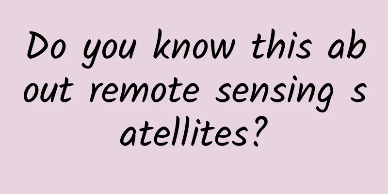
Do you know this about remote sensing satellites?
|
Xinhua News Agency, Beijing, May 31 (Reporter Liu Yaxuan) Weather forecasts can be accurate to the hour, illegal buildings can be found "nowhere to hide", and changes in the ecological environment of cultivated land can be known "in seconds". How can the relevant departments know the root causes of these small things happening around us? All of this comes from remote sensing satellites thousands of miles away. Remote sensing satellites refer to satellites that use remote sensing technology and remote sensing equipment to synchronously observe the earth. A reporter recently learned from the China Remote Sensing Application Association that there are currently more than 200 remote sensing satellites in orbit in my country. At 12:02 on March 13, 2023, my country successfully launched the Horus 2 remote sensing satellite into space using the Long March 2C carrier rocket at the Jiuquan Satellite Launch Center. The satellite successfully entered the predetermined orbit and the launch mission was a complete success. Xinhua News Agency (Photo by Wang Jiangbo) These more than 200 remote sensing satellites are like "eyes of fire" for observers, which can monitor the slightest changes with a maximum resolution of decimeters in the first place. In other words, these "eyes" in space can distinguish the differences between buildings on the ground. This is a multi-spectral remote sensing satellite image of Jiaozhou Bay in Shandong. On November 5, 2021, my country successfully launched the Sustainable Development Science Satellite 1 at the Taiyuan Satellite Launch Center. Xinhua News Agency (Photo provided by the Chinese Academy of Sciences) Remote sensing satellites have played a vital role in ecological environment management, protection of basic farmland, forest fire prevention and rescue, and earthquake disaster relief. Some companies use hidden pipes to secretly discharge sewage at night. Under normal circumstances, it is difficult to detect, but they have nowhere to hide under infrared remote sensing imagers. As long as the factory emits waste gas and pollutants, satellites can detect them, and relevant departments can "follow the clues to solve the problem." Data from the Satellite Environment Application Center of the Ministry of Ecology and Environment shows that satellite remote sensing images have provided strong technical support for the "waste removal operations" in the Yangtze River, Yellow River and other river basins in recent years. In terms of atmospheric environment monitoring, on August 4, 2022, my country's first forest carbon sink active and passive joint observation remote sensing satellite "Jumang" was launched, marking that my country's carbon sink monitoring has entered the remote sensing era. It can realize high-precision quantitative remote sensing measurements of forest vegetation biomass, aerosol distribution, and chlorophyll fluorescence. The observation results can be applied to environmental protection, surveying and mapping, meteorology, agriculture, emergency disaster reduction and other fields. Remote sensing monitoring map of flood disasters in Yingtan City, Jiangxi Province in June 2022. (Photo source: National Disaster Reduction Center, Ministry of Emergency Management) Remote sensing satellites have also played an indispensable role in disaster reduction and relief. Especially when the disaster situation is unclear and the terrain is unfamiliar, remote sensing satellites provide important scientific and technological support for rescue teams. On September 5, 2022, a 6.8-magnitude earthquake occurred in Luding County, Ganzi Tibetan Autonomous Prefecture, Sichuan Province. Multiple remote sensing satellites "scanned" the potential secondary disaster points in the earthquake zone. The comprehensive data from drones and remote sensing satellites provided a strong basis for research and analysis for rescue command, and helped local people to transfer safely. According to the China Remote Sensing Application Association, my country has initially formed a remote sensing satellite industry application system, but there are still "shortcomings" in the popularization of applications. There are many remote sensing satellites, but the application of massive data obtained from monitoring has not kept up. We need to work hard on how to make good use of remote sensing data. Luo Ge, chairman of the China Remote Sensing Application Association, said that next, we must promote the construction of an industrial ecosystem, strengthen innovative exploration of remote sensing data applications, do a good job in related popular science work, let the public feel the value-added services brought by remote sensing technology, and contribute to the accelerated construction of a space power. |
>>: I had pimples on my skin and the doctor told me to see a cardiologist!


Recommend
What is the idea behind operating and promoting a successful event?
Recently a friend asked me on WeChat: Why is it t...
Guide to writing event operation plan!
No matter what kind of operational activities you...
The evolution of corona observation: There are too few solar eclipses, so we built one
"The setting sun is like a crescent moon, an...
How much subsidy will poor households receive for the demolition of old houses in 2022? How to apply specifically? Attached are the latest compensation standards in various places!
The gap between the rich and the poor between urb...
After my mother got Alzheimer's disease, I felt like I had a new lease of life
If her mother had not developed Alzheimer's d...
Bidding promotion: How to write creative ideas to increase clicks?
When doing bidding promotion , in addition to cho...
SEM training account structure building process!
Almost every day, someone posts messages in the b...
How much does it cost to make the Baicheng Car Moving App? Baicheng car moving small program production price inquiry
WeChat Mini Program is an application that users ...
Nissan recalls 54,000 vehicles over airbags that could deploy if doors are slammed
According to the techtimes website, due to the hi...
The "Nine-tailed Fox" who is unwilling to be a relative of human ancestors is not a good turtle
Starting from the birth of the first fish during ...
User operation: How to recall lost users at low cost?
Before writing the article, let me do some calcul...
Revision of the Science Popularization Law: Providing legal protection for science popularization information workers and promoting the development of science popularization
On December 25, 2024, the 13th session of the Sta...
Diabetic Guide丨The "Five Horsemen" run side by side to easily cope with diabetes!
Author: Fan Ting, pharmacist at Zhejiang Provinci...
Popular Science | "Centennial Sugarcane" - The Legend of the Chinese Species of Sugarcane
[ Introduction ] Sugarcane is the fifth largest c...
Permian, the last days of the Paleozoic Era, the Earth became a purgatory
For the past Humans always have a natural curiosi...