
First release in the Year of the Tiger! The Land Exploration No. 1 satellite group 01 was successfully launched, opening a new mode of space observation
|
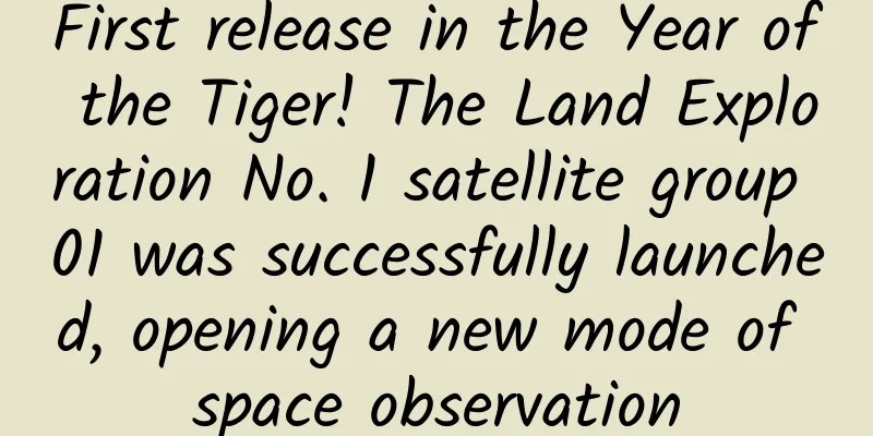
At 7:44 am on February 27, my country successfully launched the Land Exploration No. 1 Group 01B (L-band Differential Interferometry Synthetic Aperture Radar Satellite B) using the Long March 4B Yao 30 carrier rocket at the Jiuquan Satellite Launch Center. GIF source: Our Space The Land Exploration No. 1 satellite group 01 is the first scientific research satellite project approved in the "National Civilian Space Infrastructure Medium- and Long-Term Development Plan (2015-2025)", consisting of satellites A and B. Satellite A was successfully launched at the Jiuquan Satellite Launch Center on January 26, and is currently conducting in-orbit tests as planned. The satellite's related functions and performance are normal. After satellite B enters orbit, it will conduct in-orbit tests alone, and then conduct formation tests with satellite A. The technical status of the two satellites A and B of the Land Exploration No. 1 Group 01 are basically the same. Both are equipped with L-band synthetic aperture radar (SAR) payloads, and use interferometric altimetry and differential deformation measurement technology on-orbit. They can realize functions such as heavy-orbit interferometric deformation measurement, dual-satellite formation interferometric altimetry and single-satellite imaging, and complete major observation tasks such as surface deformation measurement and digital elevation model acquisition. They have the characteristics of all-weather, all-day, multi-mode, and multi-polarization, and support and serve the application needs of land resources, earthquake, disaster prevention and mitigation, basic geographic information acquisition, forestry, etc., and can form a rapid response capability to major disasters. After the Land Exploration No. 1 01 Group A and B dual satellites are networked and operated in orbit, a new mode of space observation will be opened. Video source: China Aerospace Science and Technology Corporation Eighth Academy Through the clouds and rain: high-precision terrain mapping As an important national basic geographic information data, digital elevation models have important application value in the implementation of major national strategies, large-scale engineering construction, disaster assessment, geological mapping, urban and rural planning, land use and other fields. "For example, we want to build 5G base stations and UHV transmission lines, and these facilities are often located on slopes, hills, and mountains. Information such as slope, aspect, ridgeline, and valley line can provide important data support for the reasonable layout of these sites." Chen Yunli, chief designer of the Land Exploration No. 1 satellite group 01, introduced that there are many mountainous areas and hills in my country, and manual mapping is time-consuming and dangerous. Optical remote sensing is restricted by the cloudy and rainy climate characteristics in most parts of my country, and it is impossible to obtain real-time data. The characteristics of radar satellites enable them to penetrate clouds and surface vegetation to achieve all-weather, all-day, and high-precision observations, which have unique advantages in terrain mapping. Using the principle of wave interference, one of the two satellites transmits a radar signal. When the two satellites receive the ground echo at the same time, they can invert the distance difference between the ground and the two satellites through processing, and then obtain the ground elevation information. It is reported that Land Exploration No. 1 Group 01 is the world's first L-band distributed formation multi-polarization interferometric SAR altimetry satellite system, with a ground observation resolution of meters and a ground elevation measurement accuracy that meets the 1:50,000 scale standard. It can provide important technical support for the construction of my country's natural resources survey system, the construction and update of global geographic information resources, and the update of high-precision terrain data. Precise coordination: two stars dancing together in a beautiful scene The principle of interferometric SAR altimetry requires that the two satellites need to observe the earth within a specific range of viewing angle difference. However, the two satellites are constantly orbiting, and the distance and viewing angle difference between the two satellites are constantly changing. In addition, the satellites must leave enough safety distance to avoid collisions. This poses unprecedented challenges to the design and control of the satellite formation configuration. "According to the requirements of dual-satellite interferometry altitude measurement, the two satellites need to fly hand in hand in space at all times, just like the pair figure skating dancers in the Winter Olympics. They must not only ensure the accuracy and stability of their respective technical movements, but also take into account the coordination and cooperation of the two's movements. Unlike a performance of several minutes, the satellite in orbit needs to overcome the influence of various complex interference factors within the mission cycle to achieve stable operation." said Wei Chun, deputy chief designer of the Land Exploration No. 1 Group of satellites. Taking into account the limited fuel allocation and long-term operation requirements, the research and development team proposed a new method for the design and precise maintenance of the flyby formation configuration. They used the Earth's gravitational perturbation relationship to optimize the configuration of the binary satellite orbit parameters. At the same time, they designed an autonomous maintenance technology for the formation configuration based on precise pulse control. The flyby configuration parameters are precisely controlled at the meter level, reaching the international advanced level. Star Spirit Communication: Two Stars Collaborate to Paint the Earth Dual-satellite in-orbit interferometric altimetry requires the two satellites to maintain a high degree of consistency in three dimensions: time, space, and phase. Li Ruixiang, chief commander of the Land Exploration No. 1 satellite group 01, said: "Our B satellite and A satellite are designed to be consistent, so they can be called a pair of 'twins', which fundamentally guarantees consistency. In addition, the two satellites can also be interconnected through intersatellite links in orbit." The research and development team innovatively proposed a series of new technologies based on three-dimensional attitude guidance and control of formation satellites and non-interrupted dual-base imaging, which can effectively ensure the synchronization performance of the two satellites. The three-dimensional attitude guidance and control technology based on real-time formation configuration can effectively improve the spatial synchronization performance of the Land Exploration No. 1 Group 01 two-satellite long baseline formation flight. Wang Yu, deputy chief designer of the Land Exploration-1 Group 01 satellite, introduced that my country has adopted the non-interrupted dual-base imaging mode for the first time in the world, which fundamentally solves the problem that dual-base satellite-borne SAR imaging and phase synchronization cannot be carried out simultaneously, can greatly improve the phase synchronization accuracy, and has formed independent intellectual property rights in the world. This mission is the 408th flight of the Long March series of launch vehicles. Source: Science and Technology Daily Comprehensive sources: Science and Technology Daily, China Aerospace News, Shanghai Aerospace, Our Space, etc. |
>>: International Polar Bear Day丨How can they survive in the gradually warming Arctic?


Recommend
There will be no New Year's Eve this year! In the next five years, "30" will be absent for consecutive years →
Today (January 17), the 2022 Spring Festival trav...
The World Cup is coming, how can brands take advantage of it to promote their products?
When it comes to sports marketing, you may think ...
Smart eating in winter - cooking secrets to reduce salt without reducing flavor
The salt intake in the diet of Chinese residents ...
Is it true that every Sichuanese has a giant panda? This group of people replied: It was all "cheated"!
Imagine if there was a job that allowed you to av...
More and more young people are diagnosed with thyroid problems. To protect the "bow tie" in your body, start with these 4 things
The thyroid gland, a butterfly-shaped gland locat...
How did Apple perform in 2019? Read these 10 stories and you'll understand
In 2019, Apple had some major and minor incidents...
11-year-old boy's heart stopped beating for 52 hours! Beware of fulminant myocarditis
Recently, an 11-year-old boy in Guangdong suffere...
The fourth issue of the Dragon and Tiger Song God main promotion system small circle (September-October 2021)
Resource introduction of the fourth phase of the ...
Pinduoduo operation: 3 tips to improve store conversion
1. Product internal strength 1. Introduce accurat...
Let us show you how to acquire customers through omni-channel marketing on “Double 11”!
Recently, I have seen many friends sharing the QR...
Payment system design: How does Yingke guide users to pay for the anchors step by step?
Two days ago, Fu Yuanhui made her first live broa...
From Alipay to Luo Yixiao, which one should focus on is results or the bottom line?
On November 30, 2016, the " Luo Yixiao "...
The form of opening screen advertising!
Mobile advertising comes in many forms. For mobil...
Why are wetlands called the “Kidneys of the Earth”?
Did you know that wetlands only cover 6% of the E...
Do you still watch TV? The results of a survey of more than 50,000 people are shocking...
Recently, a survey conducted by Fudan University ...