
How did plate tectonic movement start? Is it from geothermal energy?
|
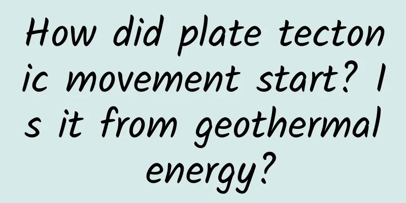
Preface The seas run dry and the rocks crumble, and the world changes drastically. This is a beautiful love story for lovers. But for the 4.6 billion-year-old Earth, it is the embodiment of the hot heart and tenacious vitality of its core. The hot vitality has never stopped. The supercontinents have been separated and reunited, creating the seven continents of the world today. In the vast solar system, the moon is of a similar age to the Earth, adding a lot of brilliance to our nights. Now it is also moving away from the Earth at a distance of 5 centimeters per year. The "plate drift theory" proposed by German geologist Wegener in 1912 made us realize that the changes in the world are not accidental. So where does the driving force of the "plate tectonics" that shapes the surface of the Earth come from? Is it caused by the hot vitality inside the Earth - geothermal heat, or by changes in the tidal force of the Earth caused by other planets such as the moon? Figure 1 The eight planets in the solar system are all rocky planets The Birth of the Earth Why did the Earth become the cradle of life? How was the Earth different from today when it was first created? There are many theories and hypotheses about the origin of the Earth. The most mainstream one is that the Earth, like other planets in the solar system, was formed by a mixture of dust and gas in the early solar system. They kept rotating around the solar system, and eventually they collided from tiny dust particles and gathered into stones, turned into boulders, and then became larger "asteroids." The early Earth became larger and heavier, and the impact of asteroids and meteorites also made the Earth's interior hotter and hotter, which was also the source of the Earth's initial heat. At the beginning of the Earth's birth, there were many radioactive elements with short half-lives. These elements decayed into stable materials a long time ago, but they released a lot of heat at the beginning and continued to heat the Earth, which also created a core temperature of 4000-6800 degrees Celsius, comparable to the temperature of the sun. American geophysicist J. Marvin Herndon mentioned in his theory that the earth is like a huge natural nuclear reactor. Radioactive elements are concentrated 3,000 kilometers below the earth's surface, releasing heat through natural decay and nuclear fission. This is the second and main source of heat, and the reason why the earth generates a magnetic field, providing heat for volcanoes and plate tectonic movements. Some scientists believe that tidal heating between the Earth and celestial bodies such as the Sun, Moon and other planets is also a heat source. Over time, the Earth's surface gradually cooled, forming the crust, mantle and core we know today. Figure 2 The newborn Earth was very hot Age of the Earth Claire Patterson, Meteorites and the Age of the Earth When did the hot earth become a planet suitable for human habitation? We know that geological processes on the earth are extremely slow. Compared with the short life of human beings, the earth can be considered "infinitely old", so how old is it? In 1785, James Hutton, the father of modern geology, said in "The Theory of the Earth" that geological phenomena can be explained by natural processes that can be seen today. These processes have been proceeding slowly, with no visible beginning or end. Hutton's words also enlightened many people later, allowing us to find the history of the earth from a piece of rock. Following this logic, scientists from the late 19th century to the early 20th century discovered radioactive elements. In 1903, Marie Curie and others won the Nobel Prize in Physics for discovering the radioactive element radium. In the same year, Rutherford published a paper pointing out that for each radioactive isotope, the decay rate of the radioactive parent isotope at any time is proportional to the remaining amount of the parent at that time. This proportional coefficient is constant and is called the "decay constant"; the time taken for each isotope to decay to half of the initial total amount is also constant, which is called the "half-life" of this isotope. The discovery of radioactive elements has unexpectedly great significance for geology. During her doctoral studies, American geochemist Claire Patterson followed her mentor, Professor Brown, to study the determination and calculation of lead isotope content in meteorites. His mentor, Professor Brown, derived the mathematical principles behind dating: uranium 235 and uranium 238 will undergo a series of decays according to their respective probabilities, becoming lead 207 and lead 206 respectively. So in theory, you only need to know how much lead and uranium there is in a sample now, and how much lead there is when it was formed, to get its age (as shown in Figure 3). The mentor told him that as long as he followed this method, he would be able to calculate the age of the earth. Therefore, Patterson was still obsessed with calculating the age of the earth several years after graduating from his doctorate. But finding meteorites that are contemporary with the earth is a difficult task. In 1956, he discovered a sample from the Canyon Diablo meteorite in Arizona, which was a meteorite with a state similar to that of the Earth. He could not wait to take it to the Argonne National Laboratory (ANL) at the University of Chicago to measure the decay of isotopes. Argonne National Laboratory was once the test base of the "Manhattan Project" and has the most advanced mass spectrometer in the world. The experimental results came out quickly, 4.55±0.7 billion years. This is the precise age of the Earth, and 50 years later it is still considered the closest test to the age of the Earth. Meteorites from the orbit of the solar system help us understand the birth of the Earth; the decay of radioactive elements inside the Earth is still ongoing. Figure 3. Decay chain of 238U, the final product is 206Pb Plate drift Alfred Wegener, The Origin of Continents and Oceans Another German geologist with a strong curiosity and spirit of exploration, Alfred Wegener, proposed the "continental drift theory" in 1912. By comparing the topographic contours of Africa and South America (as shown in Figure 4), he found that their outer contours were so similar, and there was a mountain range running from east to west in South Africa that could be connected to a mountain in Argentina, so he imagined that the continent should have been a complete continent at a certain time. At the same time, Wegener also used fossils to prove his point. Glossopteris is a fern plant 250 million years ago. Glossopteris fossils have been found in Africa, South America, Australia, India and Antarctica. Glossopteris is distributed in such a large area, so Wegener is convinced that these continents were once a whole. Because the roe deer of Glossopteris could not have migrated long distances across the ocean, because on the one hand, its "seeds" are too large to drift with the wind; on the other hand, it is easy to break and cannot float across the ocean. So why can Glossopteris grow in such a vast area? Wegener inferred that these continents were once connected into a super ancient continent at that time. Figure 4 Mosaic of the outlines of Africa and South America So what is the reason for the plate drift and the formation of the current world map of seven continents and four oceans? Evolutionists such as Wegener believe that the Pangaea continent broke into several pieces under the influence of celestial tidal forces and the centrifugal force generated by the rotation of the earth, causing the crust to separate and drift in the asthenosphere (the mantle layer with a temperature of up to 1,300 degrees). The entire plate movement process was very slow and took 540 million years. So is the plate drift really due to the rotation of the earth and the gravity of celestial bodies as evolutionists say? Is the process really so slow and gradual? If this "supercontinent" was attracted by the gravity of other celestial bodies, it would probably drift as a whole and might not be dispersed into the seven continents today. So there must be a deeper reason for the "tearing of the earth's plates." If the seawater on the surface of the earth is drained, can the exposed seafloor topography prove the theory of continental drift? At that time, Wegener must have never thought that people would never stop studying plate tectonic movement. The first seafloor map "North Atlantic Topographic Map" published in 1957 allowed the public to see the mid-ocean ridges, trenches, and volcanic circles around the Atlantic Ocean for the first time. The constantly improved seafloor maps (as shown in Figure 5) allow us to rethink the theory of plate tectonic movement and continental drift. Figure 5 Earth without Water (eastgbg.se) From the latest published seafloor topographic map, we can see that the rift valley system on the seafloor is 80,000 kilometers long, which is long enough to circle the earth twice, forming a huge sea ridge, or mid-ocean ridge. The area of the entire sea ridge accounts for about 1/3 of the ocean area. The mid-ocean ridge is also the most active volcanic area. These submarine volcanic belts are large in scale, especially the Pacific Ring of Fire. Some volcanic belts are still slowly active today. The most famous "Atlantic Ridge" extends almost from the Arctic to the Antarctic, is 15,000 kilometers long, 500-900 kilometers wide, and has a relative height of 2-3 kilometers. Figure 6 The direction of movement of the seafloor crust is consistent with the direction of continental drift. Please pay attention to the arrow in the figure above (quoted from Zhihu) Modern science has discovered that through the age measurement of rocks near the mid-ocean ridge, the red part represents the youngest rock layer, the yellow represents the relatively young, the green is the second, and the blue represents the relatively old rock layer. In other words, these volcanoes distributed along the mid-ocean ridge all erupted simultaneously along the ridge at some time in the past. It can be said that the ridge is the ironclad evidence of plate tectonics. It can be seen that the shape of the ridge is consistent with the shape of the continental split, and the direction of the movement of the submarine crust is also consistent with the direction of continental drift (arrows in the figure), indicating that the expansion and movement of the oceanic crust is the main force driving the splitting and drifting of the continent. Figure 7 shows the eruption of submarine volcanoes, the formation of submarine mid-ocean ridges, and the continuous outflow of molten rocks, causing the oceanic crust to subduct into the continental plate. The eruption of the volcano is like the center of a water wave, and the molten rock is like a water wave, pushing the movement of the continental plate layer by layer. Figure 7 Concentrated eruption of submarine volcanoes causes collision between oceanic and continental plates Iceland has become a unique existence on the "sea ridge". In the north of the Atlantic Ridge, due to the continuous strengthening of volcanic activity, the volcanic lava continued to cool and accumulate, and eventually it emerged from the sea, becoming an island and evolving into a country. At present, there are still more than 200 volcanoes on the island, including more than 40 active volcanoes. Volcanic activity is very frequent and geothermal energy is very rich. Today, everyone talks about "renewable energy". The huge geothermal energy under Iceland is the most desired real renewable clean energy. Big Scar on Earth On the east side of the African continent, there is a crack about thousands of kilometers long, which almost tears the African continent apart. It is also called the largest scar on the earth. The East African Great Rift Valley is divided into two branches, the east and the west (as shown in Figure 8). The western branch of the rift runs from south to north along the west side of Lake Victoria, all the way to the White Nile River in Sudan. It is relatively small in scale, with a total length of about 1,700 kilometers. The eastern branch of the rift is the main rift area, along the east side of Lake Victoria, north to the Red Sea, and then extends from the Red Sea to the northwest to the Jordan Valley, with a total length of about 6,000 kilometers. The rift zone here is about tens to 200 kilometers wide, and the valley bottom is mostly relatively flat. There are steep cliffs on both sides of the rift, with a height difference ranging from a few hundred meters to 2,000 meters. The plate tectonic theory believes that about 30 million years ago, the crustal plates underwent tectonic movement and volcanic eruptions, forming the prototype of this rift. There are many volcanoes on both sides of the rift valley, Mount Kilimanjaro and Mount Kenya are the most famous, among which Mount Kilimanjaro is also known as the "Roof of Africa". Figure 8 The eastern and western branches of the East African Rift Valley The East African Rift is the later developed one of the three rift zones, the Red Sea-Gulf of Aden-East African Rift. The Red Sea-Gulf of Aden belongs to the newly cracked ocean, while the East African Rift is located inside the African plate. The three just happen to form a rift with an angle of nearly 120 degrees. So is this rift pattern just a coincidence or does it have certain scientific principles? Back to the Great Rift Valley and the Red Sea, after the Red Sea split into plate boundaries, there was only a very narrow mid-ocean ridge, and almost no oceanic crust was formed. Only the Gulf of Aden has a mid-ocean ridge that has formed oceanic crust (see Figure 6). That is to say, the Red Sea and the East African Rift Valley have not yet developed into a mid-ocean ridge system that can split on its own, and still need the catalysis of deep mantle hot spots to continue to split. So whether the East African Rift Valley will split into a new continent over a long period of time, as shown in Figure 9, will require more evidence. Figure 9 The East African Rift Valley may drift out into a new continent in the future (referenced by the Planet Science Bureau) Earth's thermal balance Professor Zhang Zuheng's radioactive heat production Mr. Zhang Zuhuan is a famous expert in uranium geology and isotope geology in my country. He wrote an article in the Journal of Minerals, Rocks and Geochemistry published in 1986, pointing out that the geothermal energy generated by the continuous decay of natural radioactive elements in the earth's interior will inevitably have a significant impact on the movement of the earth's crust and the evolution of the earth, and even a decisive impact. He believes that the heat generated by the decay is very huge. According to his calculations, if there is no effective heat release mechanism, the heat generated by radioactive decay can cause the entire crust to melt after hundreds of millions of years of accumulation. Professor Zhang Zuhuan believes that the reason why this situation does not occur is that while the heat inside the earth is accumulating, it is also continuously released to the outside of the earth through various channels. These release methods mainly include: (1) heat is continuously released to the surface through heat conduction; (2) due to mantle convection and upwelling of mantle materials, geothermal heat is released to the outside of the earth in large quantities through mid-ocean ridges, large rift valleys, deep fault mountains, as well as magmatic activities, volcanic activities and hot springs; (3) geothermal energy is converted into mechanical energy, causing plate activities, folds, faults, earthquakes, etc.; regional metamorphism deep in the crust may also consume some heat energy. Professor Zhang Zuhao further pointed out that there are different cycles of geothermal accumulation and release inside the earth. In the "accumulation cycle", the accumulation rate of geothermal heat is relatively balanced and slow, and the duration is relatively long. It belongs to the quantitative change process, representing the relatively stable period of the earth. When the accumulation reaches a certain stage, the original relative equilibrium state is destroyed, which will cause qualitative changes and contradictions to transform and enter the "release cycle". At this time, the release rate of geothermal heat is often violent and rapid, manifested as volcanic activity, magma activity, crustal movement and seismic activity, etc., and the duration is relatively short, representing the relatively active period of the earth. Every global crustal movement will cause a large amount of geothermal heat to be released. When the crustal movement tends to calm down, it will enter a period dominated by geothermal accumulation. The surface is often relatively cold, which will cause the emergence of a global ice age. Earth Crack Professor Tang Chunan's Earth Crack Among the many mechanisms of heat release from the Earth, the most effective method must be a global-scale rift in the lithosphere. Professor Tang Chunan, a rock mechanics expert in my country who is obsessed with the study of cracking, proposed a new theory of Earth evolution based on the cross-scale effect of the cracking phenomenon: the Great Earth Rift. This hypothesis proposes a completely new model for the heat release mechanism of the Earth. When studying cracks, Professor Tang Chunan curiously discovered that the crack images of cell division fossils 600 million years ago were exactly the same as the crack images of mud balls played by rural children. Except for the different scales, the crack images of the two were so geometrically similar that he thought of the reconstructed images of supercontinent breakup, which made him boldly assume that the Earth's plate tectonics might be a large crack in the Earth that conforms to the principles of mechanics. Figure 10 Cross-scale nature of cracks Professor Tang Chunan used a rock fracture process analysis software RFPA developed by his team to simulate and analyze the fracture caused by the internal temperature increase and expansion of the spherical shell, and successfully reproduced the cracking process on the surface of the spherical shell. This result of the explanation of the origin of early plates quickly attracted the attention of more experts in the academic community, and was eventually published in Nature Communications. It also attracted commentary reports or reprints from dozens of mainstream media at home and abroad, and was included in the international Encyclopedia of Geology. Although the plate tectonic hypothesis is well known, how the plates are formed and how the plate tectonics is initiated remain unsolved mysteries. Professor Tang Chunan believes that the magma ocean of the early Earth formed a hard lithosphere during the cooling process, which hindered the effective release of heat energy from the Earth's interior, causing the Earth to warm up and expand, and eventually caused the lithosphere to quickly break into multiple plates, thus providing a new explanation based on mechanical principles for the unresolved issue of the origin of plates in the geological community. At the same time, the Great Rift in the Earth also provides a new explanation model for the heat release of the Earth. Based on the new theory of the Great Rift in the Earth, we can better understand that the evolutionary history of the Earth is a history of damage to the Earth's rupture evolution driven by heat, and a history of gradual decay evolution of the Earth's heat energy that is continuously accumulated and released during the polymerization and cracking of the lithosphere. Figure 11. Simulation of spherical shell cracking based on the rock fracture process analysis system (RFPA). The left figure shows the displacement distribution and the right figure shows the stress field distribution. References: 1. Claire Patterson, Age of meteorites and the earth, 1956 2. Alfred Wegener, The Origin of Continents and Oceans, Alfred Wegener, 1912 3. Map, Earth Without Water (eastgbg.se) 4. Heezen and Tharp's, Physiographic Map of the North Atlantic, 1957 5. Zhang Zuhuan, The relationship between geothermal accumulation and release and crustal movement and earth evolution, Mineral Rock Geochemistry Communications, No. 2, 1986. 6. CA Tang, AAG Webb, WB Moore, YY Wang, THMa & TTchen, Breaking Earth's shell into a global plate network, Nature communications, 2020 |
>>: Many places are so hot that people are "doubting life". Is it all caused by El Niño?


Recommend
Summer is hot! Doctor runner unlocks the secrets of scientific fluid replenishment before and after exercise
Written by Fu Jingbo (Chief Surgeon of Peking Uni...
20 forms of Internet advertising, 5 billing methods, and 10 ROI evaluation indicators
Internet advertising generally follows the follow...
I have a user portrait, but why can’t I understand the user?
The concept of user portrait has been around for ...
How to play with information flow advertising? Improving CTR is the key to gaining exposure
As an important part of native advertising, infor...
VisionMobile: 2015 Mobile Developer Trends Report
The 2015 Mobile Developer Report surveyed more th...
Why is it said that the Jiangcun Tomb is the Mausoleum of Emperor Wen of Han?
On the morning of the 14th, the State Administrat...
A guide for preventing insults in self-media, you will regret not having read this book when you need it!
How to “prevent scolding”? Generally speaking, it...
Well-known musician passed away, and was hospitalized several times due to pneumothorax! Be alert if you have these symptoms, it may be your body's "call for help"
According to media reports, the well-known musici...
Baidu bidding: It only costs 2400 to open an account with Baidu!
If you want to save your later advertising costs,...
Marketing is sick, is there a cure for copywriting?
Many brands use low prices to increase product sa...
Nine tech gadgets you can implant in your body
Given the crazy hype surrounding Apple's intr...
The purpose of SAIC and Audi's marriage should be more creative
The news that SAIC and Audi will establish a join...
Sugarcane during Qingming Festival is more poisonous than snakes! The poisoning is about to peak. Please do not eat it carelessly! Do not eat it carelessly!
Next month is the Qingming Festival. There is a d...
From 0 to 1, private domain conversion methodology
Today’s summary: 1. What abilities does a project...
Family members, helmets really can save lives! It’s not just talk!
When driving on the road, safety is the most impo...